Satellite Data
- All
- News
- Videos
-

Back-To-Back PSLV Rocket Setbacks For ISRO, 16 Satellites Lost In Space
- Monday January 12, 2026
- India News | Reported by Pallava Bagla
India's Polar Satellite Launch Vehicle (PSLV) mission on Monday encountered an anomaly after launch, with the Indian Space Research Organisation (ISRO) confirming that a deviation was observed during the rocket's third stage.
-
 www.ndtv.com
-

ISRO's Aditya-L1 Study Reveals How October 2024 Solar Storm Affected Earth's Magnetic Field
- Sunday January 11, 2026
- Science | Edited by Astitva Raj
ISRO scientists and research students studied the solar storm using observations from India's Aditya-L1 mission.
-
 www.ndtv.com
-

The Next Space Frontier May Be Just 100 km Above Earth, Not the Moon or Mars
- Monday January 5, 2026
- Written by Gadgets 360 Staff
As low Earth orbit becomes crowded, very low Earth orbit satellites are emerging as a promising alternative. Operating closer to Earth, they offer faster communication, sharper imaging, and better weather data. Advances in propulsion are helping overcome atmospheric drag, opening the door to wider use of this challenging but valuable orbital region...
-
 www.gadgets360.com
-

Chinese Scientists Discover Eight Water-Formed Caves On Mars
- Friday January 2, 2026
- Science | Edited by Astitva Raj
This discovery adds a new dimension to the geoscience of Mars and opens up new possibilities for the search for life outside Earth.
-
 www.ndtv.com
-

Google’s Space-Based AI Data Centre Plan Faces Collision Risks in an Increasingly Crowded Orbit
- Saturday December 27, 2025
- Written by Gadgets 360 Staff
Google’s Project Suncatcher aims to build a solar-powered AI data center in space. Experts warn the crowded Sun-synchronous orbit poses high collision risks from space debris, and without autonomous safeguards, even a single impact could trigger a cascade, scattering millions of fragments. This project underscores the urgent need for orbital debr...
-
 www.gadgets360.com
-

Private Satellites Pinpoint Methane Emissions from Oil, Gas, and Coal Facilities Worldwide
- Tuesday December 16, 2025
- Written by Gadgets 360 Staff
Private satellites tracked methane emissions from thousands of oil, gas, and coal facilities globally, revealing major hotspots and providing crucial data for targeted climate action.
-
 www.gadgets360.com
-

Farm Fires Didn't End, They Just Moved To Afternoon: Satellite Data Analysis
- Tuesday December 9, 2025
- India News | Reported by Shreya Ghosh
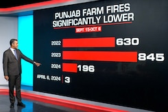
Claims of a nearly 90% drop in stubble burning in Punjab and Haryana - a key contributor to pollution in Delhi-NCR - have been challenged by a new multi-satellite analysis, revealing that the decline is a result of a gap in India's monitoring system.
-
 www.ndtv.com
-

Starlink Executive Clarifies: India Pricing Was a 'Glitch', Still Awaiting Launch Approval
- Tuesday December 9, 2025
- Written by Dhruv Raghav, Edited by David Delima
Starlink, a wholly-owned subsidiary of Elon Musk's SpaceX, recently updated its website the reveal the prices of its Residential subscription in India. Soon after the revelation, the satcom firm received flak for relatively high pricing. Now, Lauren Dreyer, the Vice President of Business Operations at Starlink, has clarified in a post on X that the...
-
 www.gadgets360.com
-

Venus' Winds Race Around The Planet At Extreme Speeds Due To Solar Heat
- Sunday November 30, 2025
- Science | Edited by Astitva Raj
New findings suggest that diurnal tides, driven by solar heat, are a major contributor to the extreme speeds of Venus's winds.
-
 www.ndtv.com
-

Volcanic Ash Missed India, But Pollution Risks Haven't: Doctors Warn, Share Tips
- Wednesday November 26, 2025
- Health | Written by Shreya Goswami
Satellite data confirms that the Ethiopian volcanic ash plume passed over parts of India but never reached ground-level concentrations harmful to people. However, Delhi's already severe pollution remains a major health threat.
-
 www.ndtv.com
-

Volcanic Ash Missed India, But Pollution Risks Haven't: Doctors Warn, Share Tips
- Wednesday November 26, 2025
- NDTV
Satellite data confirms that the Ethiopian volcanic ash plume passed over parts of India but never reached ground-level concentrations harmful to people. However, Delhi's already severe pollution remains a major health threat.
-
 doctor.ndtv.com
-

AI in Space: Why Elon Musk, Google, and Amazon Want to Make It the Next Frontier?
- Monday November 17, 2025
- Written by Akash Dutta, Edited by Rohan Pal
Major AI companies are exploring space-based data centres to cut energy and cooling costs. Google is researching solar-powered TPU satellites under Project Suncatcher, while Nvidia-backed Starcloud is preparing to launch an H100-equipped satellite powered entirely by solar energy. Leaders like Jeff Bezos and Elon Musk have also expressed interest, ...
-
 www.gadgets360.com
-

SpaceX Sends Sentinel-6B to Orbit for Precision Sea-Level Tracking
- Monday November 17, 2025
- Written by Gadgets 360 Staff
SpaceX successfully launched the Sentinel-6B ocean-monitoring satellite on November 17, 2025, marking its 500th orbital mission using a reused Falcon 9 booster. Sentinel-6B will extend more than 40 years of continuous sea-level measurement, delivering high-precision global ocean data as part of Europe’s Copernicus climate program. Equipped with a...
-
 www.gadgets360.com
-

Researchers Expose Shocking Vulnerabilities in Satellite Communications
- Thursday November 13, 2025
- Written by Gadgets 360 Staff
Researchers using basic satellite equipment intercepted thousands of unencrypted transmissions from space, exposing sensitive data such as corporate communications, text messages, and even government links. The study highlights major security flaws in satellite networks used worldwide. Experts warn the findings reveal how easily hackers could explo...
-
 www.gadgets360.com
-

Back-To-Back PSLV Rocket Setbacks For ISRO, 16 Satellites Lost In Space
- Monday January 12, 2026
- India News | Reported by Pallava Bagla
India's Polar Satellite Launch Vehicle (PSLV) mission on Monday encountered an anomaly after launch, with the Indian Space Research Organisation (ISRO) confirming that a deviation was observed during the rocket's third stage.
-
 www.ndtv.com
-

ISRO's Aditya-L1 Study Reveals How October 2024 Solar Storm Affected Earth's Magnetic Field
- Sunday January 11, 2026
- Science | Edited by Astitva Raj
ISRO scientists and research students studied the solar storm using observations from India's Aditya-L1 mission.
-
 www.ndtv.com
-

The Next Space Frontier May Be Just 100 km Above Earth, Not the Moon or Mars
- Monday January 5, 2026
- Written by Gadgets 360 Staff
As low Earth orbit becomes crowded, very low Earth orbit satellites are emerging as a promising alternative. Operating closer to Earth, they offer faster communication, sharper imaging, and better weather data. Advances in propulsion are helping overcome atmospheric drag, opening the door to wider use of this challenging but valuable orbital region...
-
 www.gadgets360.com
-

Chinese Scientists Discover Eight Water-Formed Caves On Mars
- Friday January 2, 2026
- Science | Edited by Astitva Raj
This discovery adds a new dimension to the geoscience of Mars and opens up new possibilities for the search for life outside Earth.
-
 www.ndtv.com
-

Google’s Space-Based AI Data Centre Plan Faces Collision Risks in an Increasingly Crowded Orbit
- Saturday December 27, 2025
- Written by Gadgets 360 Staff
Google’s Project Suncatcher aims to build a solar-powered AI data center in space. Experts warn the crowded Sun-synchronous orbit poses high collision risks from space debris, and without autonomous safeguards, even a single impact could trigger a cascade, scattering millions of fragments. This project underscores the urgent need for orbital debr...
-
 www.gadgets360.com
-

Private Satellites Pinpoint Methane Emissions from Oil, Gas, and Coal Facilities Worldwide
- Tuesday December 16, 2025
- Written by Gadgets 360 Staff
Private satellites tracked methane emissions from thousands of oil, gas, and coal facilities globally, revealing major hotspots and providing crucial data for targeted climate action.
-
 www.gadgets360.com
-

Farm Fires Didn't End, They Just Moved To Afternoon: Satellite Data Analysis
- Tuesday December 9, 2025
- India News | Reported by Shreya Ghosh
Claims of a nearly 90% drop in stubble burning in Punjab and Haryana - a key contributor to pollution in Delhi-NCR - have been challenged by a new multi-satellite analysis, revealing that the decline is a result of a gap in India's monitoring system.
-
 www.ndtv.com
-

Starlink Executive Clarifies: India Pricing Was a 'Glitch', Still Awaiting Launch Approval
- Tuesday December 9, 2025
- Written by Dhruv Raghav, Edited by David Delima
Starlink, a wholly-owned subsidiary of Elon Musk's SpaceX, recently updated its website the reveal the prices of its Residential subscription in India. Soon after the revelation, the satcom firm received flak for relatively high pricing. Now, Lauren Dreyer, the Vice President of Business Operations at Starlink, has clarified in a post on X that the...
-
 www.gadgets360.com
-

Venus' Winds Race Around The Planet At Extreme Speeds Due To Solar Heat
- Sunday November 30, 2025
- Science | Edited by Astitva Raj
New findings suggest that diurnal tides, driven by solar heat, are a major contributor to the extreme speeds of Venus's winds.
-
 www.ndtv.com
-

Volcanic Ash Missed India, But Pollution Risks Haven't: Doctors Warn, Share Tips
- Wednesday November 26, 2025
- Health | Written by Shreya Goswami
Satellite data confirms that the Ethiopian volcanic ash plume passed over parts of India but never reached ground-level concentrations harmful to people. However, Delhi's already severe pollution remains a major health threat.
-
 www.ndtv.com
-

Volcanic Ash Missed India, But Pollution Risks Haven't: Doctors Warn, Share Tips
- Wednesday November 26, 2025
- NDTV
Satellite data confirms that the Ethiopian volcanic ash plume passed over parts of India but never reached ground-level concentrations harmful to people. However, Delhi's already severe pollution remains a major health threat.
-
 doctor.ndtv.com
-

AI in Space: Why Elon Musk, Google, and Amazon Want to Make It the Next Frontier?
- Monday November 17, 2025
- Written by Akash Dutta, Edited by Rohan Pal
Major AI companies are exploring space-based data centres to cut energy and cooling costs. Google is researching solar-powered TPU satellites under Project Suncatcher, while Nvidia-backed Starcloud is preparing to launch an H100-equipped satellite powered entirely by solar energy. Leaders like Jeff Bezos and Elon Musk have also expressed interest, ...
-
 www.gadgets360.com
-

SpaceX Sends Sentinel-6B to Orbit for Precision Sea-Level Tracking
- Monday November 17, 2025
- Written by Gadgets 360 Staff
SpaceX successfully launched the Sentinel-6B ocean-monitoring satellite on November 17, 2025, marking its 500th orbital mission using a reused Falcon 9 booster. Sentinel-6B will extend more than 40 years of continuous sea-level measurement, delivering high-precision global ocean data as part of Europe’s Copernicus climate program. Equipped with a...
-
 www.gadgets360.com
-

Researchers Expose Shocking Vulnerabilities in Satellite Communications
- Thursday November 13, 2025
- Written by Gadgets 360 Staff
Researchers using basic satellite equipment intercepted thousands of unencrypted transmissions from space, exposing sensitive data such as corporate communications, text messages, and even government links. The study highlights major security flaws in satellite networks used worldwide. Experts warn the findings reveal how easily hackers could explo...
-
 www.gadgets360.com


