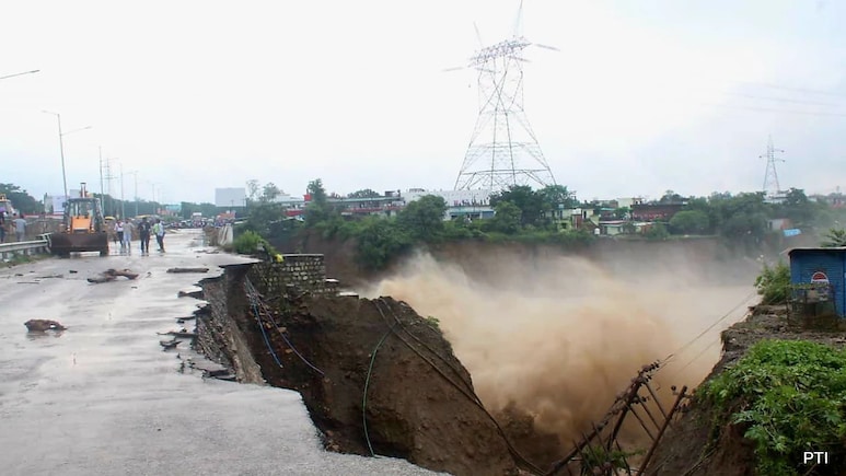
- Temple and houses submerged in Dehradun due to heavy rain and flash floods
- Dehradun recorded 67 mm of rain per hour, below cloudburst threshold of 100 mm
- Heavy rain caused by interaction between easterly and westerly air masses
Temple and houses submerged, a 100-meter-long road being washed away, rowdy Tamsa river and a gush of water on the road - the visuals of extreme heavy rain in Dehradun are spine-chilling. While the overnight rainfall has left behind a trail of damage, it has once again reminded us that climate change is real, and we are bearing its impact in the form of extreme events, including flash floods, cloudbursts and landslides.
"The latest episode, which is heavy rain in Uttarakhand's Dehradun on Monday night, cannot be defined as a cloudburst," Dr Chander Singh Tomar, Head of India Meteorological Centre, Dehradun, told NDTV in a telephonic interview.
Also Read: Temple Submerged, Houses Damaged: Videos Of Dehradun Cloudburst Horror
The India Meteorological Department (IMD) defines a cloudburst as an intense downpour of rain, recording 100 mm (4 inches) or more of rainfall within an hour over an area. Dehradun reported 67 mm of rain per hour, said Mr Tomar. "This comes under the category of an extreme, intense spell of rain," he added.
Explaining the cause behind this sudden spell of rain, Mr Tomar said, "Interaction between easterlies (winds that blow from east to west) and westerlies (winds that blow from west to east) or air masses over the region leads to heavy precipitation."
The weather expert called it "usual" and said this spell was expected, and an "orange alert" was issued and will remain in place till September 17, 8:30 am.
"Very heavy rainfall is expected in Dehradun, Nainital and Champawat. Heavy rainfall in Chamoli, Udham Singh Nagar, Bageshwar and Pithoragarh regions," he added.
Also Read: Houses, IT Park Submerged As Heavy Rain Triggers Flash Floods In Dehradun
According to the IMD data, 1103.2 mm of rainfall is considered "normal". Since the start of the monsoon on June 1, Uttarakhand has received 1343.2 mm of rainfall, which is 22 per cent excess.
Within the state, Bageshwar district has received 239 per cent surplus rainfall.
The variations in monsoon - surplus or deficit - are normal and not exceptional, said Mr Tomar.
Contrary to this, Yaspal Sundriyal, Former Head and Professor, Department of Geology, HNB Garhwal University, attributed this change to climate change.
"Different air masses - cold, warm and occluded - are intersecting with each other, forming a triple junction, leading to intense weather events like heavy precipitation, thunderstorms and strong winds. This intersection can be attributed to climate change," said Mr Sundriyal.
The geologist added that forest fires produce black carbon and nuclides, which mix with clouds and cause cloudbursts. "This year we didn't see many episodes of forest fires, but there has been a history of it," he added.
"Several researchers have found that while the rainfall graph has seen a downward curve, extreme rainfall events have increased. This means, we now see more rain at one go causing severe damage than the same amount of rain spread over several weeks," Mr Sundriyal added.
The amount of rain that we used to get in four to five days now occurs in a day or eight to 10 hours, resulting in flash floods.
Track Latest News Live on NDTV.com and get news updates from India and around the world

