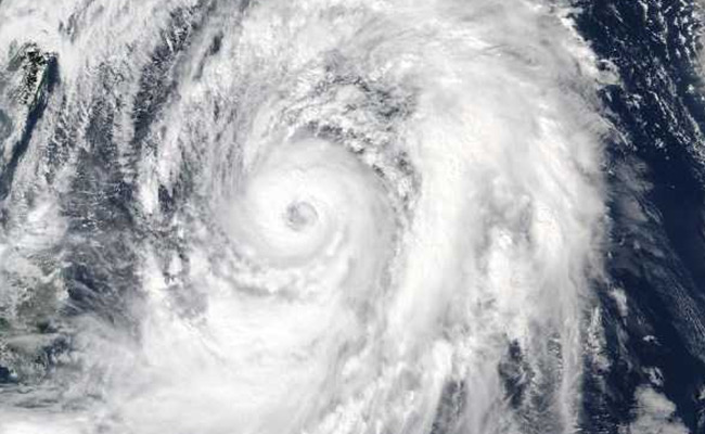
Japan is bracing for heavy rains and high winds on Wednesday as a strong typhoon is forecast to make landfall near the capital of Tokyo, the latest storm to hit Japan in recent months.
Typhoon "Shanshan", a Chinese girl's name, is currently a Category 2 typhoon but is expected to weaken slightly as it moves closer to the eastern part of Japan's main island of Honshu, drawing near to Tokyo in the early hours of Thursday and possibly snarling the morning rush hour.
-

-
 World-Class Chefs, Food And Music: The Fun Side Of NDTV World Summit 2026
-
 AI, Consciousness And Dharma: Why Ancient Indian Wisdom Matters Now
-
 NDTV World Summit: What To Expect From PM Modi's Keynote Address
-
 NDTV World Summit 2026: What To Watch Out For | PM Modi, Jaishankar, AI And Global Power Shifts
-
 A World Between Orders: What To Expect At NDTV World Summit 2026
-
 Who Is Rajiv Mehta? Lilavati Hospital Trustee To Speak At NDTV World Summit 2026
-
 Alain Ebobisse, Africa50 CEO, To Attend NDTV World Summit 2026. All About Him
-
 Kriti Sanon At NDTV World Summit: A Look At Her Career And Business Ventures
-
 Ex-CIA Director To Decode 'War In Times Of AI' At NDTV World Summit
-
 Who Is Vikram Rai, CEO, South Asia GE Aerospace, Set To Attend The NDTV World Summit 2026
The Japanese Meteorological Agency warned that Tokyo and surrounding areas could get as much as 350 mm of rain in the 24 hours to noon on Thursday, with winds gusting as high as 180 kmh.
Shanshan is expected to move extremely slowly, perhaps as slow as 15 kmh, meaning intense rain may fall in one area for an extended period.
After pounding the area near Tokyo the storm is expected to rake the northeastern part of Honshu before weakening to tropical storm strength and heading out into the Pacific.
Western Japan, the site of deadly floods in July, will be spared.
Japan has been hit by one weather disaster after another since the start of July, including a record-breaking heatwave that saw temperatures surge to 41.1 Celsius (106 Fahrenheit) and killed at least 132 people as of August 5.