Isro Satellite Images
- All
- News
- Videos
-

ISRO to Launch PSLV-C62 With EOS-N1 Hyperspectral Satellite on January 12
- Saturday January 10, 2026
- Written by Gadgets 360 Staff
ISRO is set to launch PSLV-C62 on January 12, 2026, carrying the advanced EOS-N1 hyperspectral satellite. The mission marks a crucial return to flight after a 2025 anomaly and will strengthen India’s Earth-observation, defence surveillance and environmental monitoring capabilities.
-
 www.gadgets360.com
-

Have You Seen First Radar Images Of Earth's Surface By NASA-ISRO Satellite Yet?
- Friday September 26, 2025
- World News | NDTV News Desk
Launched on July 30 from Andhra Pradesh's Srikharikota, the NASA-ISRO satellite tracks changes on Earth's land and ice surfaces.
-
 www.ndtv.com
-

NASA-ISRO Earth Observation Satellite Unfolds Giant Radar Antenna in Space
- Tuesday August 19, 2025
- Written by Gadgets 360 Staff
NASA and ISRO’s joint NISAR mission has successfully deployed its 12-meter radar reflector in orbit. This unique satellite, carrying dual L-band and S-band radars, will monitor Earth’s glaciers, volcanoes, earthquakes, and ecosystems with unmatched accuracy. The milestone reflects decades of research and showcases the strength of U.S.-India spa...
-
 www.gadgets360.com
-

NASA-ISRO's $1.3 Billion Satellite NISAR Deploys Its Antenna In Orbit
- Saturday August 16, 2025
- India News | Reported by Pallava Bagla
In a landmark moment for global Earth science and international space collaboration, the world's most expensive civilian Earth imaging satellite-the NASA-ISRO Synthetic Aperture Radar (NISAR)-has successfully deployed its radar antenna in orbit.
-
 www.ndtv.com
-

New Video Shows Exact Moment Uttarkashi Flood Engulfed Dharali Village
- Wednesday August 13, 2025
- India News | Edited by NDTV News Desk
A new video from old Dharali showing the exact moment a deadly wall of water and debris smashed the Uttarkashi settlement on August 5, sending residents scrambling for safety and engulfing the village within seconds, has surfaced.
-
 www.ndtv.com
-

ISRO Pics Show Impact Of Floods On Uttarakhand's Dharali, Bhagirathi River
- Monday August 11, 2025
- India News | NDTV
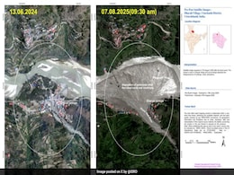
The Indian Space Research Organisation has released satellite images from before and after flashfloods and landslides in Uttarakhand's Uttarkashi district in the first week of August.
-
 www.ndtv.com
-

What Caused Uttarkashi Flash Floods? ISRO Satellite Images Reveal Clues
- Friday August 8, 2025
- India News | Reported by Aishvarya Jain
The devastating mudslide that swept through the Dharali area in Uttarkashi has left the region reeling.
-
 www.ndtv.com
-

How ISRO's Satellite Insights Are Helping Uttarkashi Disaster Relief Ops
- Friday August 8, 2025
- India News | Edited by NDTV News Desk
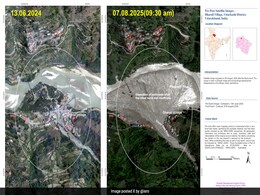
Satellite images, extracted by the Indian Space Research Organisation (ISRO), have revealed the scale of destruction caused by the deadly flash floods in Uttarakhand's Uttarkashi earlier this week.
-
 www.ndtv.com
-

Rain Data Doesn't Support Claim Cloudburst Caused Uttarkashi Disaster: Experts
- Wednesday August 6, 2025
- India News | Press Trust of India
A cloudburst in the upper catchment of the Kheer Ganga river is widely believed to have triggered the flash flood in Uttarkashi's Dharali, but experts feel the amount of rain the Uttarkashi district received on Tuesday was not enough.
-
 www.ndtv.com
-

ISRO Successfully Launches NISAR, World's Most Expensive Earth Imaging Satellite
- Wednesday July 30, 2025
- India News | Reported by Pallava Bagla, NDTV News Desk
The world's most expensive civilian Earth imaging satellite NISAR (NASA-ISRO Synthetic Aperture Radar Satellite) has lifted off from Sriharikota in Andhra Pradesh.
-
 www.ndtv.com
-

Earth Imaging Satellite NISAR Exposes NASA's Weaknesses, ISRO's Strengths
- Saturday July 26, 2025
- World News | Written by Pallava Bagla
Wendy Edelstein, NISAR's Deputy Project Manager at NASA's Jet Propulsion Laboratory (JPL), asserted, "NISAR is a 50-50 partnership between NASA and ISRO".
-
 www.ndtv.com
-

ISRO-NASA's $1.3 Billion Revolutionary Earth Imaging Satellite NISAR Set For Launch
- Thursday July 24, 2025
- India News | Reported by Pallava Bagla
In a historic collaboration between the United States and India, the NASA-ISRO Synthetic Aperture Radar satellite, also known as NISAR, is poised to revolutionise how we observe and understand our planet.
-
 www.ndtv.com
-

With ISRO Satellite Launch, Night-Time Surveillance Capability To Get Boost
- Saturday May 17, 2025
- India News | Written by Pallava Bagla
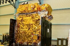
The indigenously-made "spy" satellite is equipped to capture high-resolution images of the Earth's surface under all weather conditions and in low light.
-
 www.ndtv.com
-

ISRO Satellite Images Show Damage After Earthquake Rattled Myanmar
- Tuesday April 1, 2025
- World News | Written by Pallava Bagla
The Indian Space Research Organisation (ISRO) has released satellite images of the widespread damages caused by the 7.7 magnitude earthquake that struck Myanmar and rattled neighbouring countries on Friday.
-
 www.ndtv.com
-

ISRO Successfully Launches Two SpaDeX Satellites, Completes Space Docking Test Flight
- Tuesday December 31, 2024
- Written by Gadgets 360 Staff
India has launched its first space docking mission, SpaDeX, using the PSLV-C60 rocket from the Satish Dhawan Space Centre in Andhra Pradesh. The mission involves deploying two spacecraft into a 470-km orbit to demonstrate docking technology and power transfer between satellites. Advanced payloads, including imaging systems and radiation monitors, w...
-
 www.gadgets360.com
-

ISRO to Launch PSLV-C62 With EOS-N1 Hyperspectral Satellite on January 12
- Saturday January 10, 2026
- Written by Gadgets 360 Staff
ISRO is set to launch PSLV-C62 on January 12, 2026, carrying the advanced EOS-N1 hyperspectral satellite. The mission marks a crucial return to flight after a 2025 anomaly and will strengthen India’s Earth-observation, defence surveillance and environmental monitoring capabilities.
-
 www.gadgets360.com
-

Have You Seen First Radar Images Of Earth's Surface By NASA-ISRO Satellite Yet?
- Friday September 26, 2025
- World News | NDTV News Desk
Launched on July 30 from Andhra Pradesh's Srikharikota, the NASA-ISRO satellite tracks changes on Earth's land and ice surfaces.
-
 www.ndtv.com
-

NASA-ISRO Earth Observation Satellite Unfolds Giant Radar Antenna in Space
- Tuesday August 19, 2025
- Written by Gadgets 360 Staff
NASA and ISRO’s joint NISAR mission has successfully deployed its 12-meter radar reflector in orbit. This unique satellite, carrying dual L-band and S-band radars, will monitor Earth’s glaciers, volcanoes, earthquakes, and ecosystems with unmatched accuracy. The milestone reflects decades of research and showcases the strength of U.S.-India spa...
-
 www.gadgets360.com
-

NASA-ISRO's $1.3 Billion Satellite NISAR Deploys Its Antenna In Orbit
- Saturday August 16, 2025
- India News | Reported by Pallava Bagla
In a landmark moment for global Earth science and international space collaboration, the world's most expensive civilian Earth imaging satellite-the NASA-ISRO Synthetic Aperture Radar (NISAR)-has successfully deployed its radar antenna in orbit.
-
 www.ndtv.com
-

New Video Shows Exact Moment Uttarkashi Flood Engulfed Dharali Village
- Wednesday August 13, 2025
- India News | Edited by NDTV News Desk
A new video from old Dharali showing the exact moment a deadly wall of water and debris smashed the Uttarkashi settlement on August 5, sending residents scrambling for safety and engulfing the village within seconds, has surfaced.
-
 www.ndtv.com
-

ISRO Pics Show Impact Of Floods On Uttarakhand's Dharali, Bhagirathi River
- Monday August 11, 2025
- India News | NDTV
The Indian Space Research Organisation has released satellite images from before and after flashfloods and landslides in Uttarakhand's Uttarkashi district in the first week of August.
-
 www.ndtv.com
-

What Caused Uttarkashi Flash Floods? ISRO Satellite Images Reveal Clues
- Friday August 8, 2025
- India News | Reported by Aishvarya Jain
The devastating mudslide that swept through the Dharali area in Uttarkashi has left the region reeling.
-
 www.ndtv.com
-

How ISRO's Satellite Insights Are Helping Uttarkashi Disaster Relief Ops
- Friday August 8, 2025
- India News | Edited by NDTV News Desk
Satellite images, extracted by the Indian Space Research Organisation (ISRO), have revealed the scale of destruction caused by the deadly flash floods in Uttarakhand's Uttarkashi earlier this week.
-
 www.ndtv.com
-

Rain Data Doesn't Support Claim Cloudburst Caused Uttarkashi Disaster: Experts
- Wednesday August 6, 2025
- India News | Press Trust of India
A cloudburst in the upper catchment of the Kheer Ganga river is widely believed to have triggered the flash flood in Uttarkashi's Dharali, but experts feel the amount of rain the Uttarkashi district received on Tuesday was not enough.
-
 www.ndtv.com
-

ISRO Successfully Launches NISAR, World's Most Expensive Earth Imaging Satellite
- Wednesday July 30, 2025
- India News | Reported by Pallava Bagla, NDTV News Desk
The world's most expensive civilian Earth imaging satellite NISAR (NASA-ISRO Synthetic Aperture Radar Satellite) has lifted off from Sriharikota in Andhra Pradesh.
-
 www.ndtv.com
-

Earth Imaging Satellite NISAR Exposes NASA's Weaknesses, ISRO's Strengths
- Saturday July 26, 2025
- World News | Written by Pallava Bagla
Wendy Edelstein, NISAR's Deputy Project Manager at NASA's Jet Propulsion Laboratory (JPL), asserted, "NISAR is a 50-50 partnership between NASA and ISRO".
-
 www.ndtv.com
-

ISRO-NASA's $1.3 Billion Revolutionary Earth Imaging Satellite NISAR Set For Launch
- Thursday July 24, 2025
- India News | Reported by Pallava Bagla
In a historic collaboration between the United States and India, the NASA-ISRO Synthetic Aperture Radar satellite, also known as NISAR, is poised to revolutionise how we observe and understand our planet.
-
 www.ndtv.com
-

With ISRO Satellite Launch, Night-Time Surveillance Capability To Get Boost
- Saturday May 17, 2025
- India News | Written by Pallava Bagla
The indigenously-made "spy" satellite is equipped to capture high-resolution images of the Earth's surface under all weather conditions and in low light.
-
 www.ndtv.com
-

ISRO Satellite Images Show Damage After Earthquake Rattled Myanmar
- Tuesday April 1, 2025
- World News | Written by Pallava Bagla
The Indian Space Research Organisation (ISRO) has released satellite images of the widespread damages caused by the 7.7 magnitude earthquake that struck Myanmar and rattled neighbouring countries on Friday.
-
 www.ndtv.com
-

ISRO Successfully Launches Two SpaDeX Satellites, Completes Space Docking Test Flight
- Tuesday December 31, 2024
- Written by Gadgets 360 Staff
India has launched its first space docking mission, SpaDeX, using the PSLV-C60 rocket from the Satish Dhawan Space Centre in Andhra Pradesh. The mission involves deploying two spacecraft into a 470-km orbit to demonstrate docking technology and power transfer between satellites. Advanced payloads, including imaging systems and radiation monitors, w...
-
 www.gadgets360.com


