





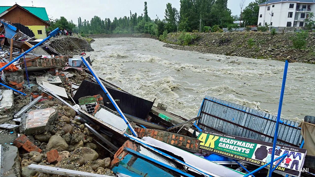
More than 20 lives have been lost owing to deadly flash floods and landslides in Jammu and Kashmir. Days of relentless monsoon have triggered widespread destruction, entire villages have been inundated, roads washed away, and communications cut off as rescue teams bolt to reach stranded families.
The recent wave of flash floods, landslides, and cloudbursts across Jammu and Kashmir has caused severe damage to human lives, riverbanks, and critical infrastructure and has even triggered many questions on why such events occur. To understand the cause, one has to look at a host of factors triggering the event.
Meteorological Factors
One must also understand the scientific trigger behind the disaster. When analysing the meteorological factors, Professor Ankit Agarwal from the Department of Hydrology at IIT-Roorkee emphasises that these disasters are far from simple, isolated rain events.
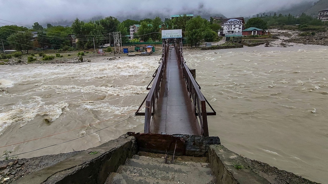
Photo Credit: PTI
Professor Agarwal says the disaster must be viewed as a 'compound hydro-meteorological event', rather than simply as 'three consecutive days of rain'. He further explains the reason behind the heavy showers: "The present synoptic setting includes active monsoon conditions and a western disturbance over Jammu. When such systems overlap, monsoon moisture can be transported into the western Himalaya and converted into intense rainfall through atmospheric convergence and strong orographic lifting."
Adding on to the atmospheric angle, Professor Anuradha Sharma from the Department of Geography at the University of Jammu explains how global warming has shifted where this moisture settles: "Due to global warming, air holds more moisture increasing the intensity of rainfall; otherwise in the Himalayas, monsoon moisture used to be shed on the outer ranges is now carried further into Ladakh and inner valleys. This is why we see more summer rain and cloudbursts."
Professor Sharma further points to localised devastation as a direct consequence of this shift: "There have been 12 cloudbursts recently. The latest one hit Boniyar-Baramulla, Doda's Bhalessa, and the Gurez-Tulail mountains, causing debris flows and flash floods with little warning. The Sukhnag nallah in Budgam overflowed to its highest level since 2014."
The Rugged Terrain
After torrential rain hits the mountainous terrain, it is the physical geography that determines how quickly the situation turns into a disaster. Professor Anuradha Sharma notes how J&K's rugged terrain and the condition of its inability to soak water into the ground contributes to the problem: "The Western Himalaya where J&K is situated, has rugged terrain and steep slopes of Pir Panjal, Chenab Valley, and others. When the percolation doesn't happen flash floods occur and steep terrain triggers landslides, mudslides and shooting stones resulting in the rise of Chenab, Tawi, Darhali, Khandli, and Sukhtoh rivers above danger marks within a few hours."
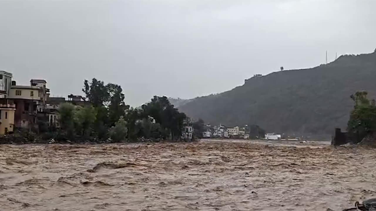
Photo Credit: IANS
However, the damage isn't just driven by how steep the land; instead, it also depends heavily on how much rain fell in the days prior. Professor Agarwal highlights the crucial role of rainfall: "The persistence of rainfall is equally important. After repeated wet spells, soils, slopes and small mountain catchments progressively lose their capacity to absorb or safely convey additional water. Consequently, even a subsequent moderate-to-heavy spell can generate rapid runoff, landslides, debris flows and cascading damage to roads, bridges, electricity and communication networks."
Geological Fragility
Well beyond the surface soil, the underlying rock structure of the Western Himalayas is geologically young and tectonically active. Much of J&K's mountains consist of weak, fractured rocks. During heavy rain spells, water seeps into the cracks and joints between these rock layers. This builds intense internal pressure, causing entire hillsides shear off into mass landslides.
In addition to this, minor earthquakes create microscopic cracks in the bedrock. This causes subterranean channels to allow rainwater to seep underground and destabilising the mountains from within.
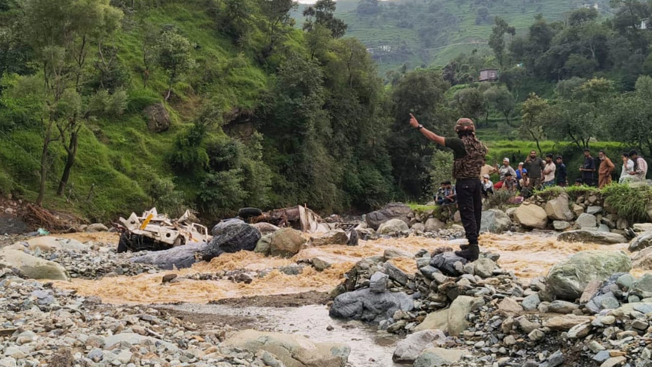
Photo Credit: PTI
Soaring temperatures at higher altitudes are constantly altering how ice and snow act, creating fast-moving water threats far above human settlements. As glaciers melt and retreat, they leave behind fragile lakes bound only by loose rocks and dirt. A sudden cloudburst or falling ice can break these natural dams, sending tonnes of water and debris crashing down steep valleys with no prior warning. As warm rainfall reaches high-altitude snowpack, it melts the snow, creating far more runoff water.
Heavy rain may start the process, but human construction along steep mountain slopes exacerbates scope for landslides. Building on highways, local roads, and rail lines often requires cutting into steep hillsides without building strong retaining walls or planting soil-binding vegetation. Eventually, this triggers the slope to lose its strength and collapse rapidly when soaked with rain.
Floodwaters move into valley floors with amplified destructive force because the landscape has lost its natural sponges and protective cover. Historically, Kashmir's wetlands, marshes, and spill channels acted as natural sponges that absorbed excess river water. Transforming low-lying areas into housing, commercial zones, and farms forces all runoff directly into narrow river channels, causing embankments to overflow rapidly. Cutting down trees on steep catchments removes canopy foliage that slows down heavy rain and destroys root networks that bind the soil.
Human Exposure
Professor Sharma draws attention to vulnerable settlement patterns along water bodies: "Many villages are built on river embankments and nallah banks. The Darhali embankment collapsed in Rajouri. Shops near the Sukhnag embankment in Beerwah were swept away. At least 654 vulnerable villages with 7.22 lakh people have been identified as at risk. Rajouri, Poonch, Reasi, Jammu, Baramulla, Budgam, Doda are the risk zones."
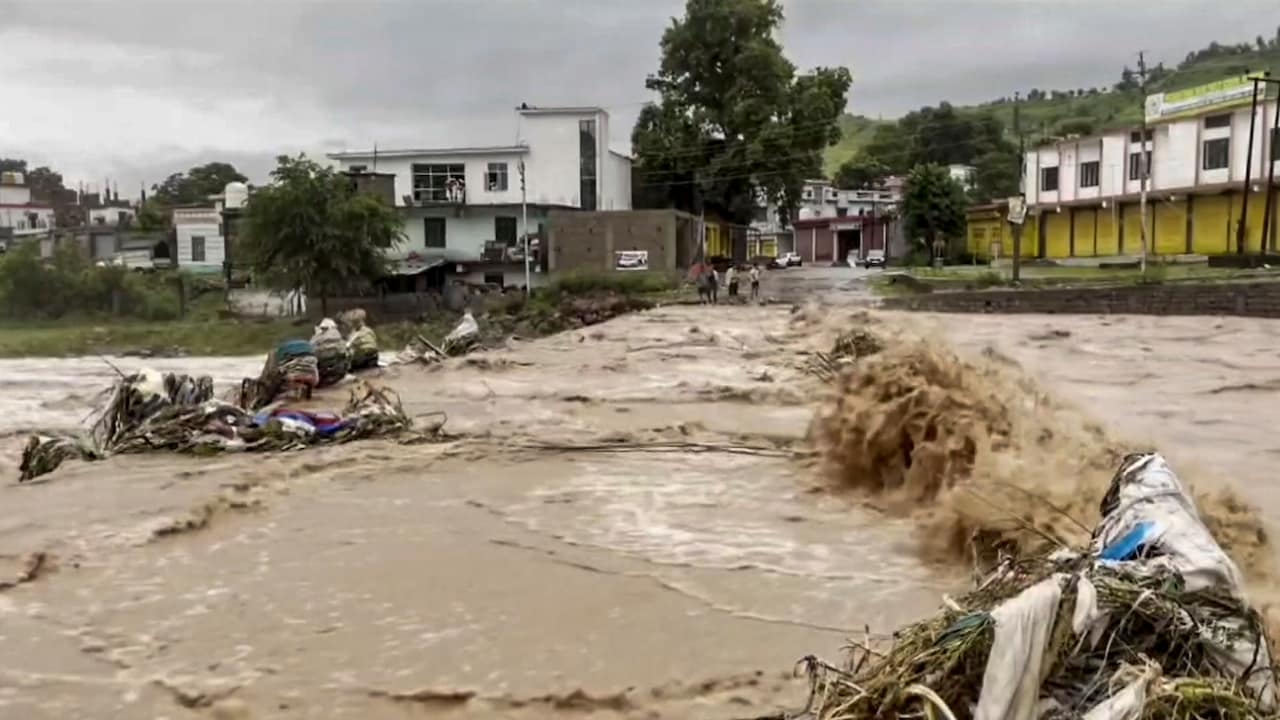
Photo Credit: PTI
In order to protect the vulnerable communities, traditional forecasting must evolve. Rather than simply warning about total rainfall amounts, Professor Agarwal advocates for a comprehensive, impact-driven warning framework: "This highlights the need to move beyond rainfall-total warnings towards catchment-scale, impact-based forecasting that combines antecedent wetness, atmospheric moisture transport, terrain and infrastructure exposure."
The disasters in Jammu and Kashmir are not driven by a single isolated factor. Preventing any further damage would require respecting the limits of nature, enforcing strict slope and floodplain regulations.
Track Latest News Live on NDTV.com and get news updates from India and around the world

