Use Satellite Images
- All
- News
- Videos
-

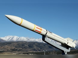
Iran Carried Out An Undeclared Missile Test Despite War With Israel
- Friday September 26, 2025
- World News | Associated Press
Iran has likely carried out an undeclared missile test at its Imam Khomeini Spaceport, satellite photos showed Thursday, underlining Tehran's effort to maintain its weapons program despite the 12-day war with Israel in June.
-
 www.ndtv.com
-

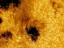
Astronomers Capture Sharpest-Ever Solar Flare Images with NSF’s DKIST Telescope
- Wednesday August 27, 2025
- Written by Gadgets 360 Staff
Astronomers have achieved a major breakthrough by capturing the sharpest images of a solar flare ever recorded, using the National Science Foundation’s Daniel K. Inouye Solar Telescope (DKIST). Observed at the hydrogen-alpha wavelength during the decay of an X1.3-class solar flare, the images unveiled hundreds of ultra-fine coronal loops averagin...
-
 www.gadgets360.com
-

Old US Spy Satellite Images To Guide New Blueprint For Ganga Revival
- Tuesday August 19, 2025
- India News | Press Trust of India
The Uttar Pradesh government announced on Monday that, in a historic initiative to chart a course for the Ganga River's future through its past, the National Mission for Clean Ganga (NMCG) had launched a major project led by IIT Kanpur.
-
 www.ndtv.com
-

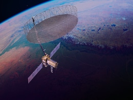
NASA-ISRO Earth Observation Satellite Unfolds Giant Radar Antenna in Space
- Tuesday August 19, 2025
- Written by Gadgets 360 Staff
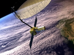
NASA and ISRO’s joint NISAR mission has successfully deployed its 12-meter radar reflector in orbit. This unique satellite, carrying dual L-band and S-band radars, will monitor Earth’s glaciers, volcanoes, earthquakes, and ecosystems with unmatched accuracy. The milestone reflects decades of research and showcases the strength of U.S.-India spa...
-
 www.gadgets360.com
-

China Launches PRSS-01 to Elevate Pakistan’s Space and Disaster Response
- Sunday August 3, 2025
- Written by Gadgets 360 Staff
China successfully launched Pakistan’s first dedicated remote sensing satellite, PRSS-01, aboard a Kuaizhou-1A rocket from the Xichang Satellite Launch Center in Sichuan. The satellite entered its planned orbit and will provide high-resolution imaging for civilian and governmental uses, including urban planning, land surveys, environmental monito...
-
 www.gadgets360.com
-

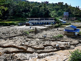
Nepal Tests AI-Powered Early Warning System To Predict Landslides
- Friday August 1, 2025
- World News | Agence France-Presse
Every morning, Nepali primary school teacher Bina Tamang steps outside her home and checks the rain gauge, part of an early warning system in one of the world's most landslide-prone regions.
-
 www.ndtv.com
-

NISAR Satellite Is India's Scientific Handshake With World: Union Minister Jitendra Singh
- Tuesday July 29, 2025
- India News | Reported by Pallava Bagla
"NISAR is not just a satellite, it is India's scientific handshake with the world" says Science Minister Dr Jitendra Singh.
-
 www.ndtv.com
-

Iran's Attack On Qatar Air Base Hit Geodesic Dome Used For US Communications
- Saturday July 12, 2025
- World News | Associated Press
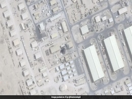
An Iranian attack on an air base in Qatar that's key to the US military hit a geodesic dome housing equipment used by the Americans for secure communications, satellite images analysed Friday by The Associated Press show.
-
 www.ndtv.com
-

FireSat Protoflight Satellite to Scan Earth Every 20 Minutes for Early Wildfire Detection
- Wednesday July 2, 2025
- Written by Gadgets 360 Staff
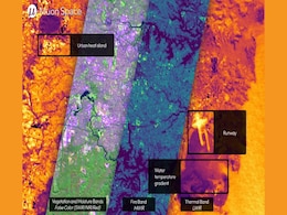
Muon Space’s FireSat project will form a 50-satellite constellation that scans the planet every 20 minutes to detect wildfires using multi-band infrared imaging. The constellation aims to support first responders and policymakers with high-resolution thermal data, bridging a critical gap in satellite-based wildfire detection. Its first satellite ...
-
 www.gadgets360.com
-

Satellite Images Show Massive Damage To Iran's Arak Nuclear Facility
- Friday June 20, 2025
- World News | Edited by Samiran Mishra
Satellite pictures from Maxar Technologies, dated June 19, confirm that Israel's recent airstrike caused substantial structural damage to Iran's heavy water reactor facility at Arak, also known as Khondab, roughly 250 kilometres southwest of Tehran.
-
 www.ndtv.com
-

ESA's Proba-3 Unveils First-Ever Artificial Solar Eclipse Images from Precision Satellite Formation
- Thursday June 19, 2025
- Written by Gadgets 360 Staff
ESA’s Proba-3 mission has captured the first artificial solar eclipse from space using two satellites flying in precise formation. This breakthrough allows frequent, high-resolution imaging of the sun’s corona, bypassing the rarity of natural eclipses. The mission opens new frontiers in solar physics and space weather research with open access ...
-
 www.gadgets360.com
-

NASA’s EZIE Satellites Begin Mission to Study Auroral Electrojets and Space Weather
- Friday March 21, 2025
- Written by Gadgets 360 Staff
NASA’s Electrojet Zeeman Imaging Explorer (EZIE) mission has been launched aboard a SpaceX Falcon 9 from Vandenberg Space Force Base. The trio of small satellites will map auroral electrojets, powerful currents in Earth’s atmosphere linked to solar storms. Their data will enhance space weather prediction models and help understand planetary mag...
-
 www.gadgets360.com
-

Google Pixel 9a Design, Colour Options Spotted in Leaked Renders and Marketing Images
- Saturday March 8, 2025
- Written by David Delima
Google Pixel 9a is expected to launch soon, and tipster Evan Blass has shared design renders showcasing the smartphone in four colour options, along with marketing images highlighting its features. Recently spotted on certification websites, the Pixel 9a is expected to be the next midrange smartphone from Google, equipped with the Tensor G4 chip us...
-
 www.gadgets360.com
-

NASA’s PUNCH Mission Set to Track the Sun’s Corona and Solar Wind in 3D
- Friday February 7, 2025
- Written by Gadgets 360 Staff
NASA’s PUNCH mission, set for launch on Feb 27, will deploy four satellites to study the transition between the sun’s corona and the solar wind. The mission aims to improve understanding of space weather by capturing 3D images, helping predict solar storms with greater accuracy. The data will also complement NASA’s Parker Solar Probe, offerin...
-
 www.gadgets360.com
-

Ancient Bronze Age Settlement Discovered in Caucasus Mountains Using Drone Mapping
- Thursday January 9, 2025
- Written by Gadgets 360 Staff
In the Caucasus Mountains, drone mapping has uncovered Dmanisis Gora, an ancient settlement dating back over 3,000 years. The project, led by Dr. Nathaniel Erb-Satullo and Dimitri Jachvliani, employed drones to capture high-resolution images of the site, revealing a vast defensive wall, graves, and other structural remains. The discovery challenges...
-
 www.gadgets360.com
-

Iran Carried Out An Undeclared Missile Test Despite War With Israel
- Friday September 26, 2025
- World News | Associated Press
Iran has likely carried out an undeclared missile test at its Imam Khomeini Spaceport, satellite photos showed Thursday, underlining Tehran's effort to maintain its weapons program despite the 12-day war with Israel in June.
-
 www.ndtv.com
-

Astronomers Capture Sharpest-Ever Solar Flare Images with NSF’s DKIST Telescope
- Wednesday August 27, 2025
- Written by Gadgets 360 Staff
Astronomers have achieved a major breakthrough by capturing the sharpest images of a solar flare ever recorded, using the National Science Foundation’s Daniel K. Inouye Solar Telescope (DKIST). Observed at the hydrogen-alpha wavelength during the decay of an X1.3-class solar flare, the images unveiled hundreds of ultra-fine coronal loops averagin...
-
 www.gadgets360.com
-

Old US Spy Satellite Images To Guide New Blueprint For Ganga Revival
- Tuesday August 19, 2025
- India News | Press Trust of India
The Uttar Pradesh government announced on Monday that, in a historic initiative to chart a course for the Ganga River's future through its past, the National Mission for Clean Ganga (NMCG) had launched a major project led by IIT Kanpur.
-
 www.ndtv.com
-

NASA-ISRO Earth Observation Satellite Unfolds Giant Radar Antenna in Space
- Tuesday August 19, 2025
- Written by Gadgets 360 Staff
NASA and ISRO’s joint NISAR mission has successfully deployed its 12-meter radar reflector in orbit. This unique satellite, carrying dual L-band and S-band radars, will monitor Earth’s glaciers, volcanoes, earthquakes, and ecosystems with unmatched accuracy. The milestone reflects decades of research and showcases the strength of U.S.-India spa...
-
 www.gadgets360.com
-

China Launches PRSS-01 to Elevate Pakistan’s Space and Disaster Response
- Sunday August 3, 2025
- Written by Gadgets 360 Staff
China successfully launched Pakistan’s first dedicated remote sensing satellite, PRSS-01, aboard a Kuaizhou-1A rocket from the Xichang Satellite Launch Center in Sichuan. The satellite entered its planned orbit and will provide high-resolution imaging for civilian and governmental uses, including urban planning, land surveys, environmental monito...
-
 www.gadgets360.com
-

Nepal Tests AI-Powered Early Warning System To Predict Landslides
- Friday August 1, 2025
- World News | Agence France-Presse
Every morning, Nepali primary school teacher Bina Tamang steps outside her home and checks the rain gauge, part of an early warning system in one of the world's most landslide-prone regions.
-
 www.ndtv.com
-

NISAR Satellite Is India's Scientific Handshake With World: Union Minister Jitendra Singh
- Tuesday July 29, 2025
- India News | Reported by Pallava Bagla
"NISAR is not just a satellite, it is India's scientific handshake with the world" says Science Minister Dr Jitendra Singh.
-
 www.ndtv.com
-

Iran's Attack On Qatar Air Base Hit Geodesic Dome Used For US Communications
- Saturday July 12, 2025
- World News | Associated Press
An Iranian attack on an air base in Qatar that's key to the US military hit a geodesic dome housing equipment used by the Americans for secure communications, satellite images analysed Friday by The Associated Press show.
-
 www.ndtv.com
-

FireSat Protoflight Satellite to Scan Earth Every 20 Minutes for Early Wildfire Detection
- Wednesday July 2, 2025
- Written by Gadgets 360 Staff
Muon Space’s FireSat project will form a 50-satellite constellation that scans the planet every 20 minutes to detect wildfires using multi-band infrared imaging. The constellation aims to support first responders and policymakers with high-resolution thermal data, bridging a critical gap in satellite-based wildfire detection. Its first satellite ...
-
 www.gadgets360.com
-

Satellite Images Show Massive Damage To Iran's Arak Nuclear Facility
- Friday June 20, 2025
- World News | Edited by Samiran Mishra
Satellite pictures from Maxar Technologies, dated June 19, confirm that Israel's recent airstrike caused substantial structural damage to Iran's heavy water reactor facility at Arak, also known as Khondab, roughly 250 kilometres southwest of Tehran.
-
 www.ndtv.com
-

ESA's Proba-3 Unveils First-Ever Artificial Solar Eclipse Images from Precision Satellite Formation
- Thursday June 19, 2025
- Written by Gadgets 360 Staff
ESA’s Proba-3 mission has captured the first artificial solar eclipse from space using two satellites flying in precise formation. This breakthrough allows frequent, high-resolution imaging of the sun’s corona, bypassing the rarity of natural eclipses. The mission opens new frontiers in solar physics and space weather research with open access ...
-
 www.gadgets360.com
-

NASA’s EZIE Satellites Begin Mission to Study Auroral Electrojets and Space Weather
- Friday March 21, 2025
- Written by Gadgets 360 Staff
NASA’s Electrojet Zeeman Imaging Explorer (EZIE) mission has been launched aboard a SpaceX Falcon 9 from Vandenberg Space Force Base. The trio of small satellites will map auroral electrojets, powerful currents in Earth’s atmosphere linked to solar storms. Their data will enhance space weather prediction models and help understand planetary mag...
-
 www.gadgets360.com
-

Google Pixel 9a Design, Colour Options Spotted in Leaked Renders and Marketing Images
- Saturday March 8, 2025
- Written by David Delima
Google Pixel 9a is expected to launch soon, and tipster Evan Blass has shared design renders showcasing the smartphone in four colour options, along with marketing images highlighting its features. Recently spotted on certification websites, the Pixel 9a is expected to be the next midrange smartphone from Google, equipped with the Tensor G4 chip us...
-
 www.gadgets360.com
-

NASA’s PUNCH Mission Set to Track the Sun’s Corona and Solar Wind in 3D
- Friday February 7, 2025
- Written by Gadgets 360 Staff
NASA’s PUNCH mission, set for launch on Feb 27, will deploy four satellites to study the transition between the sun’s corona and the solar wind. The mission aims to improve understanding of space weather by capturing 3D images, helping predict solar storms with greater accuracy. The data will also complement NASA’s Parker Solar Probe, offerin...
-
 www.gadgets360.com
-

Ancient Bronze Age Settlement Discovered in Caucasus Mountains Using Drone Mapping
- Thursday January 9, 2025
- Written by Gadgets 360 Staff
In the Caucasus Mountains, drone mapping has uncovered Dmanisis Gora, an ancient settlement dating back over 3,000 years. The project, led by Dr. Nathaniel Erb-Satullo and Dimitri Jachvliani, employed drones to capture high-resolution images of the site, revealing a vast defensive wall, graves, and other structural remains. The discovery challenges...
-
 www.gadgets360.com

