Satellite Imagery Of Iran
- All
- News
- Videos
-

Report Flags "Unusual Activity" In Satellite Pics Of Iran Nuclear Site
- Monday June 23, 2025
- World News | Reuters
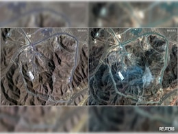
Commercial satellite imagery indicates the US attack on Iran's Fordow nuclear plant severely damaged - and possibly destroyed - the deeply-buried site and the uranium-enriching centrifuges it housed, but there was no confirmation.
-
 www.ndtv.com
-

Satellite Imagery Reveals Damage At Iran's Nuclear, Military Sites
- Friday June 20, 2025
- World News | Reported by Arjun Samar Mahendran, Vishal Vivek
In a calculated show of force, Israel has struck deep inside Iranian territory, targeting a series of high-value nuclear and military installations.
-
 www.ndtv.com
-

Satellite Images Show Damage At Iran's Nuclear Site After Israel Strikes
- Sunday June 15, 2025
- World News | NDTV Newsdesk
Satellite imagery released by Maxar Technologies revealed detailed visual evidence of the destruction caused by Israel's Operation Rising Lion against Iran, a targeted military operation to roll back the Iranian threat of nuclear weapons.
-
 www.ndtv.com
-

Iran’s Folded Rocks Reveal Ancient Tectonic Power at Asia-Europe Boundary
- Monday April 21, 2025
- Written by Gadgets 360 Staff
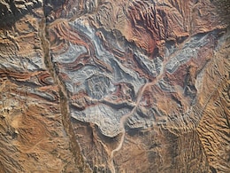
Iran’s Zagros Mountains showcase tightly folded rock layers caused by the slow-motion collision of the Arabian and Eurasian plates. Visible from space, these dramatic geological structures reveal the raw power of continental tectonics and provide scientists with valuable insights into mountain formation, seismic activity, and Earth’s ongoing st...
-
 www.gadgets360.com
-

Satellite Pics Show 500 Oil Tankers Destroyed On Afghanistan-Iran Border
- Thursday February 18, 2021
- World News | Written by Vishnu Som
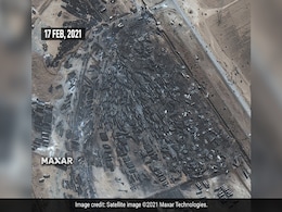
High resolution satellite imagery shows the impact of a massive fire that engulfed hundreds of trucks on February 13 at Afghanistan's Islam Qala, a key border crossing between Afghanistan and Iran's Herat province. At least 60 people were injured, news agency AFP reported.
-
 www.ndtv.com
-
US Think-Tank Says it Located Possible Blast at Iran Military Site
- Friday October 10, 2014
- World News | Reuters
A U.S. security institute said it has located via satellite imagery a section of a sprawling Iranian military complex where it said an explosion or fire might have taken place earlier this week.
-
 www.ndtv.com
-

Report Flags "Unusual Activity" In Satellite Pics Of Iran Nuclear Site
- Monday June 23, 2025
- World News | Reuters
Commercial satellite imagery indicates the US attack on Iran's Fordow nuclear plant severely damaged - and possibly destroyed - the deeply-buried site and the uranium-enriching centrifuges it housed, but there was no confirmation.
-
 www.ndtv.com
-

Satellite Imagery Reveals Damage At Iran's Nuclear, Military Sites
- Friday June 20, 2025
- World News | Reported by Arjun Samar Mahendran, Vishal Vivek
In a calculated show of force, Israel has struck deep inside Iranian territory, targeting a series of high-value nuclear and military installations.
-
 www.ndtv.com
-

Satellite Images Show Damage At Iran's Nuclear Site After Israel Strikes
- Sunday June 15, 2025
- World News | NDTV Newsdesk
Satellite imagery released by Maxar Technologies revealed detailed visual evidence of the destruction caused by Israel's Operation Rising Lion against Iran, a targeted military operation to roll back the Iranian threat of nuclear weapons.
-
 www.ndtv.com
-

Iran’s Folded Rocks Reveal Ancient Tectonic Power at Asia-Europe Boundary
- Monday April 21, 2025
- Written by Gadgets 360 Staff
Iran’s Zagros Mountains showcase tightly folded rock layers caused by the slow-motion collision of the Arabian and Eurasian plates. Visible from space, these dramatic geological structures reveal the raw power of continental tectonics and provide scientists with valuable insights into mountain formation, seismic activity, and Earth’s ongoing st...
-
 www.gadgets360.com
-

Satellite Pics Show 500 Oil Tankers Destroyed On Afghanistan-Iran Border
- Thursday February 18, 2021
- World News | Written by Vishnu Som
High resolution satellite imagery shows the impact of a massive fire that engulfed hundreds of trucks on February 13 at Afghanistan's Islam Qala, a key border crossing between Afghanistan and Iran's Herat province. At least 60 people were injured, news agency AFP reported.
-
 www.ndtv.com
-
US Think-Tank Says it Located Possible Blast at Iran Military Site
- Friday October 10, 2014
- World News | Reuters
A U.S. security institute said it has located via satellite imagery a section of a sprawling Iranian military complex where it said an explosion or fire might have taken place earlier this week.
-
 www.ndtv.com


