Nasa Satellite Images
- All
- News
- Videos
-

Satellite Constellations Like Elon Musk's Starlink Could Contaminate Space Telescope Images, NASA Warns
- Thursday December 4, 2025
- Science | Edited by Srishti Singh Sisodia
The contaminated images could impact various scientific studies, including asteroid detection and galaxy observations.
-
 www.ndtv.com
-

Have You Seen First Radar Images Of Earth's Surface By NASA-ISRO Satellite Yet?
- Friday September 26, 2025
- World News | NDTV News Desk
Launched on July 30 from Andhra Pradesh's Srikharikota, the NASA-ISRO satellite tracks changes on Earth's land and ice surfaces.
-
 www.ndtv.com
-

NASA Prepares 2025 Carruthers Mission to Explore Earth’s Hidden Hydrogen Halo
- Friday September 26, 2025
- Written by Gadgets 360 Staff
NASA’s Carruthers Geocorona Observatory, launching in 2025, will capture ultraviolet light from hydrogen atoms to map Earth’s faint geocorona. Operating a million miles sunward, it will study how solar activity drives atmospheric loss, improves satellite protection, and reveals clues to planetary habitability, providing critical insight for fut...
-
 www.gadgets360.com
-

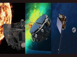
IMAP Space Weather Mission to Lift Off Soon, NASA Confirms Broadcast Plans
- Thursday September 18, 2025
- Written by Gadgets 360 Staff
NASA will stream the Sept. 23 launch of IMAP with two rideshare satellites from Kennedy Space Centre. IMAP will study the heliosphere, Carruthers will image Earth’s exosphere, and NOAA’s SWFO-L1 will provide early solar storm warnings. Together, the missions advance space weather science while protecting satellites, communications, and power sy...
-
 www.gadgets360.com
-

NASA Images Show New Island Formed by Retreat of Alaska’s Alsek Glacier
- Saturday September 20, 2025
- Written by Gadgets 360 Staff
A new island has appeared in Alaska’s Alsek Lake, revealed by NASA’s Landsat satellites. Decades of glacier retreat separated the landmass from the mainland, showcasing how fast-moving climate change is reshaping landscapes.
-
 www.gadgets360.com
-

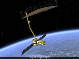
NASA-ISRO Earth Observation Satellite Unfolds Giant Radar Antenna in Space
- Tuesday August 19, 2025
- Written by Gadgets 360 Staff
NASA and ISRO’s joint NISAR mission has successfully deployed its 12-meter radar reflector in orbit. This unique satellite, carrying dual L-band and S-band radars, will monitor Earth’s glaciers, volcanoes, earthquakes, and ecosystems with unmatched accuracy. The milestone reflects decades of research and showcases the strength of U.S.-India spa...
-
 www.gadgets360.com
-

NASA-ISRO's $1.3 Billion Satellite NISAR Deploys Its Antenna In Orbit
- Saturday August 16, 2025
- India News | Reported by Pallava Bagla
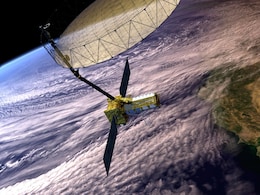
In a landmark moment for global Earth science and international space collaboration, the world's most expensive civilian Earth imaging satellite-the NASA-ISRO Synthetic Aperture Radar (NISAR)-has successfully deployed its radar antenna in orbit.
-
 www.ndtv.com
-

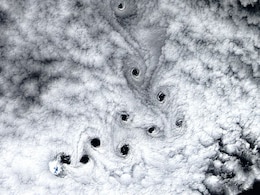
10 Strange 'Dark Voids' Appear Over Remote Island Near Antarctica in Rare Satellite View
- Sunday August 17, 2025
- Written by Gadgets 360 Staff
A rare NASA satellite image shows 10 sharply defined “dark voids” above Heard Island, a volcanic peak in the southern Indian Ocean. Formed by von Kármán vortices bent nearly 90 degrees by fierce westerly winds, the striking gaps pierce thick cloud cover, offering a vivid glimpse of nature’s intricate atmospheric patterns from space.
-
 www.gadgets360.com
-

ISRO Successfully Launches NISAR, World's Most Expensive Earth Imaging Satellite
- Wednesday July 30, 2025
- India News | Reported by Pallava Bagla, NDTV News Desk
The world's most expensive civilian Earth imaging satellite NISAR (NASA-ISRO Synthetic Aperture Radar Satellite) has lifted off from Sriharikota in Andhra Pradesh.
-
 www.ndtv.com
-

Earth Imaging Satellite NISAR Exposes NASA's Weaknesses, ISRO's Strengths
- Saturday July 26, 2025
- World News | Written by Pallava Bagla
Wendy Edelstein, NISAR's Deputy Project Manager at NASA's Jet Propulsion Laboratory (JPL), asserted, "NISAR is a 50-50 partnership between NASA and ISRO".
-
 www.ndtv.com
-

ISRO-NASA's $1.3 Billion Revolutionary Earth Imaging Satellite NISAR Set For Launch
- Thursday July 24, 2025
- India News | Reported by Pallava Bagla
In a historic collaboration between the United States and India, the NASA-ISRO Synthetic Aperture Radar satellite, also known as NISAR, is poised to revolutionise how we observe and understand our planet.
-
 www.ndtv.com
-

NASA’s Parker Probe Sends Closest-Ever Images from Inside the Sun’s Corona
- Thursday July 17, 2025
- Written by Gadgets 360 Staff
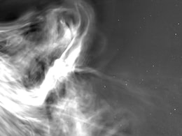
NASA’s Parker Solar Probe has achieved a solar milestone by capturing the closest-ever images of the Sun, taken just 3.8 million miles from its surface in December 2024. These WISPR images reveal unprecedented details of the corona, solar wind, and CME collisions. Scientists say this breakthrough will improve our ability to forecast space weather...
-
 www.gadgets360.com
-

NASA Satellite Captures Alaska's Iliamna Volcano From Space Amid Seismic Spike
- Tuesday June 24, 2025
- World News | Edited by Srishti Singh Sisodia
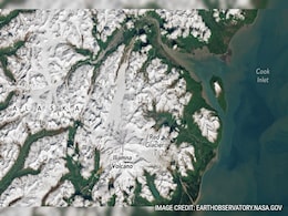
The volcano is currently considered dormant as the most recent reported eruption occurred in 1876.
-
 www.ndtv.com
-

AI Reveals Mars’s Mysterious Slope Streaks Likely Formed by Dust, Not Water Activity
- Monday June 9, 2025
- Written by Gadgets 360 Staff
An AI-based study has found that Mars’s mysterious dark slope streaks are likely formed by dust and wind, not flowing water as long believed. Based on an analysis of over 86,000 satellite images, the findings challenge past theories and may help scientists focus future Mars missions on more promising areas in the search for ancient life.
-
 www.gadgets360.com
-

NASA Satellite Shows World's Largest Iceberg Breaking Into Thousands Of Pieces. What Happens Next
- Wednesday May 21, 2025
- Science | Edited by Ritu Singh
The A23a iceberg, deemed the largest in the world since 2023, was seen losing large chunks of ice after drifting toward the island of South Georgia.
-
 www.ndtv.com
-

Satellite Constellations Like Elon Musk's Starlink Could Contaminate Space Telescope Images, NASA Warns
- Thursday December 4, 2025
- Science | Edited by Srishti Singh Sisodia
The contaminated images could impact various scientific studies, including asteroid detection and galaxy observations.
-
 www.ndtv.com
-

Have You Seen First Radar Images Of Earth's Surface By NASA-ISRO Satellite Yet?
- Friday September 26, 2025
- World News | NDTV News Desk
Launched on July 30 from Andhra Pradesh's Srikharikota, the NASA-ISRO satellite tracks changes on Earth's land and ice surfaces.
-
 www.ndtv.com
-

NASA Prepares 2025 Carruthers Mission to Explore Earth’s Hidden Hydrogen Halo
- Friday September 26, 2025
- Written by Gadgets 360 Staff
NASA’s Carruthers Geocorona Observatory, launching in 2025, will capture ultraviolet light from hydrogen atoms to map Earth’s faint geocorona. Operating a million miles sunward, it will study how solar activity drives atmospheric loss, improves satellite protection, and reveals clues to planetary habitability, providing critical insight for fut...
-
 www.gadgets360.com
-

IMAP Space Weather Mission to Lift Off Soon, NASA Confirms Broadcast Plans
- Thursday September 18, 2025
- Written by Gadgets 360 Staff
NASA will stream the Sept. 23 launch of IMAP with two rideshare satellites from Kennedy Space Centre. IMAP will study the heliosphere, Carruthers will image Earth’s exosphere, and NOAA’s SWFO-L1 will provide early solar storm warnings. Together, the missions advance space weather science while protecting satellites, communications, and power sy...
-
 www.gadgets360.com
-

NASA Images Show New Island Formed by Retreat of Alaska’s Alsek Glacier
- Saturday September 20, 2025
- Written by Gadgets 360 Staff
A new island has appeared in Alaska’s Alsek Lake, revealed by NASA’s Landsat satellites. Decades of glacier retreat separated the landmass from the mainland, showcasing how fast-moving climate change is reshaping landscapes.
-
 www.gadgets360.com
-

NASA-ISRO Earth Observation Satellite Unfolds Giant Radar Antenna in Space
- Tuesday August 19, 2025
- Written by Gadgets 360 Staff
NASA and ISRO’s joint NISAR mission has successfully deployed its 12-meter radar reflector in orbit. This unique satellite, carrying dual L-band and S-band radars, will monitor Earth’s glaciers, volcanoes, earthquakes, and ecosystems with unmatched accuracy. The milestone reflects decades of research and showcases the strength of U.S.-India spa...
-
 www.gadgets360.com
-

NASA-ISRO's $1.3 Billion Satellite NISAR Deploys Its Antenna In Orbit
- Saturday August 16, 2025
- India News | Reported by Pallava Bagla
In a landmark moment for global Earth science and international space collaboration, the world's most expensive civilian Earth imaging satellite-the NASA-ISRO Synthetic Aperture Radar (NISAR)-has successfully deployed its radar antenna in orbit.
-
 www.ndtv.com
-

10 Strange 'Dark Voids' Appear Over Remote Island Near Antarctica in Rare Satellite View
- Sunday August 17, 2025
- Written by Gadgets 360 Staff
A rare NASA satellite image shows 10 sharply defined “dark voids” above Heard Island, a volcanic peak in the southern Indian Ocean. Formed by von Kármán vortices bent nearly 90 degrees by fierce westerly winds, the striking gaps pierce thick cloud cover, offering a vivid glimpse of nature’s intricate atmospheric patterns from space.
-
 www.gadgets360.com
-

ISRO Successfully Launches NISAR, World's Most Expensive Earth Imaging Satellite
- Wednesday July 30, 2025
- India News | Reported by Pallava Bagla, NDTV News Desk
The world's most expensive civilian Earth imaging satellite NISAR (NASA-ISRO Synthetic Aperture Radar Satellite) has lifted off from Sriharikota in Andhra Pradesh.
-
 www.ndtv.com
-

Earth Imaging Satellite NISAR Exposes NASA's Weaknesses, ISRO's Strengths
- Saturday July 26, 2025
- World News | Written by Pallava Bagla
Wendy Edelstein, NISAR's Deputy Project Manager at NASA's Jet Propulsion Laboratory (JPL), asserted, "NISAR is a 50-50 partnership between NASA and ISRO".
-
 www.ndtv.com
-

ISRO-NASA's $1.3 Billion Revolutionary Earth Imaging Satellite NISAR Set For Launch
- Thursday July 24, 2025
- India News | Reported by Pallava Bagla
In a historic collaboration between the United States and India, the NASA-ISRO Synthetic Aperture Radar satellite, also known as NISAR, is poised to revolutionise how we observe and understand our planet.
-
 www.ndtv.com
-

NASA’s Parker Probe Sends Closest-Ever Images from Inside the Sun’s Corona
- Thursday July 17, 2025
- Written by Gadgets 360 Staff
NASA’s Parker Solar Probe has achieved a solar milestone by capturing the closest-ever images of the Sun, taken just 3.8 million miles from its surface in December 2024. These WISPR images reveal unprecedented details of the corona, solar wind, and CME collisions. Scientists say this breakthrough will improve our ability to forecast space weather...
-
 www.gadgets360.com
-

NASA Satellite Captures Alaska's Iliamna Volcano From Space Amid Seismic Spike
- Tuesday June 24, 2025
- World News | Edited by Srishti Singh Sisodia
The volcano is currently considered dormant as the most recent reported eruption occurred in 1876.
-
 www.ndtv.com
-

AI Reveals Mars’s Mysterious Slope Streaks Likely Formed by Dust, Not Water Activity
- Monday June 9, 2025
- Written by Gadgets 360 Staff
An AI-based study has found that Mars’s mysterious dark slope streaks are likely formed by dust and wind, not flowing water as long believed. Based on an analysis of over 86,000 satellite images, the findings challenge past theories and may help scientists focus future Mars missions on more promising areas in the search for ancient life.
-
 www.gadgets360.com
-

NASA Satellite Shows World's Largest Iceberg Breaking Into Thousands Of Pieces. What Happens Next
- Wednesday May 21, 2025
- Science | Edited by Ritu Singh
The A23a iceberg, deemed the largest in the world since 2023, was seen losing large chunks of ice after drifting toward the island of South Georgia.
-
 www.ndtv.com


