



Weather Today, Delhi-NCR Rain, Monsoon Live Updates: The national capital has crossed its average monthly rainfall for August in just the first eight days of the month, with the Safdarjung Observatory recording 230.1 mm of rain so far.
Safdarjung, the city's prime observatory, had recorded 225.7 mm of rainfall between the start of the month and till 8.30 am on Saturday, while another 4.4 mm was recorded between 8.30 am and 5.30 pm, taking the cumulative rainfall to 230.1 mm.
According to the India Meteorological Department (IMD), the mean total rainfall for August in Delhi -- based on the 1991-2020 climatological period -- is 226.8 mm.
The capital city also recorded its wettest August day in two years on Saturday, with Safdarjung receiving 98.7 mm of rainfall in the 24 hours ending at 8.30 am. The last time the city recorded more rainfall on an August day was on August 1, 2024, when 107.6 mm was recorded.
The city has been witnessing rain for the fourth consecutive day.
The IMD said light to very light rain is likely at some places in Delhi over the next two days.
Follow the Live Updates of Today Weather, Monsoon Alert In Delhi NCR, Mumbai, Rajasthan:
Today Weather LIVE: Rain Lashes Delhi, Thunderstorm Warning Issued
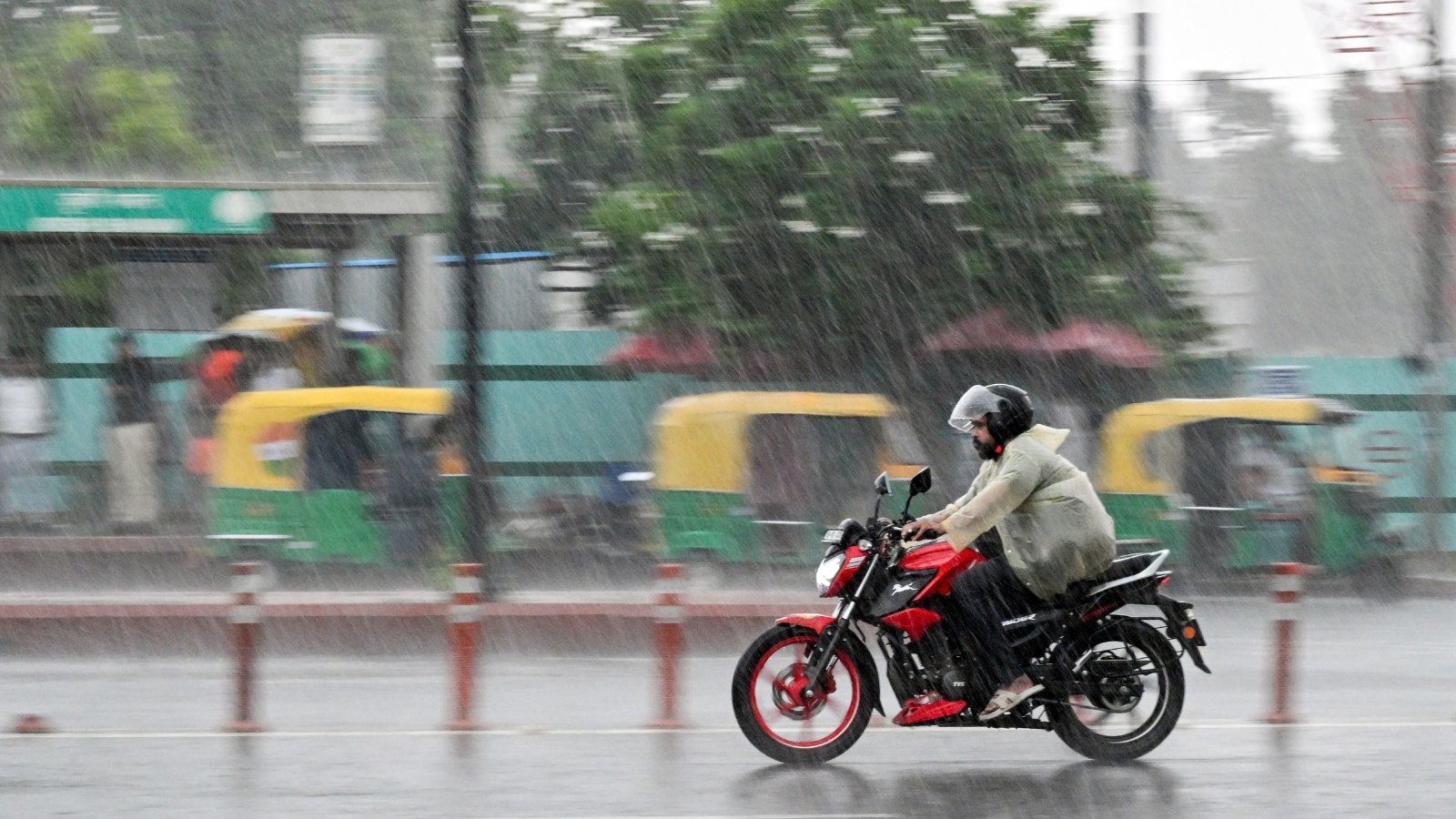
Rain lashed several parts of Delhi on Monday, with the India Meteorological Department forecasting light to moderate rain till August 16.
Mayur Vihar recorded the highest rainfall at 37 millimetres (mm), followed by Mungeshpur at 21 mm, Pusa at 4 mm and Narayana at 3 mm till 4.15 pm.
The IMD has forecast heavy to very heavy rainfall at isolated places, with the wet spell expected to continue. "Intense rain hits parts of North and Northwest Delhi," they said.
"Lightning or thunderstorms with gusty winds (around 60 kmph) and heavy rain can be expected in the next few hours in isolated areas," IMD said.
- PTI
Odisha Rain LIVE: Heavy Rain Likely In Odisha Till August 16
Heavy rainfall is likely to continue in several parts of Odisha till August 16 as a low-pressure area is expected to form over the Bay of Bengal in the next two day, the IMD said on Monday.
In its latest bulletin, the IMD's Bhubaneswar Centre said an upper-air cyclonic circulation was lying over the Bay of Bengal, and was likely to intensify into a low-pressure area around August 12.
The IMD has issued a yellow warning, advising people to remain alert, for several districts, including Balasore, Bhadrak, Jajpur, Kendrapara, Jagatsinghpur and Cuttack.
Thunderstorms accompanied by lightning and gusty surface winds are also likely at several places in the state during the day, the bulletin said.
Rainfall activity is expected to intensify further from August 12 to 15.
- PTI
Monsoon LIVE Updates: Orange Alert In Uttarakhand As Continuous Rain Triggers Preparedness Measures
Uttarakhand Disaster Management and Rehabilitation Secretary Vinod Kumar Suman on Monday said that the state has been witnessing continuous rainfall since last night, with an orange alert issued for Dehradun, Bageshwar, Nainital and Champawat.
Speaking to ANI at the Uttarakhand State Disaster Management Authority office in IT Park, Dehradun, Suman spoke about the situation arising from rainfall in the hill and plain districts in view of the India Meteorological Department's weather alert and the government's preparedness and arrangements to deal with the situation.
Suman said that more than 100 mm of rainfall has been recorded in some areas of Dehradun and some areas of Pithoragarh.
He said that the weather is expected to deteriorate again around noon. Rainfall will begin in the area around Vikas Nagar and Kalsi in Dehradun and the areas surrounding Himachal Pradesh, after which it will cover the entire state by evening.
Today Weather LIVE: Moderate Rain Likely Across Tamil Nadu
Moderate rain is expected across several parts of Tamil Nadu until Independence Day, with thunderstorms and gusty winds likely in some areas, the Regional Meteorological Centre (RMC) in Chennai has forecast.
According to the weather department, an atmospheric circulation prevailing over the North Tamil Nadu coastal region is expected to influence weather conditions across the state over the next few days.
Under its influence, several districts are likely to receive light to moderate rainfall accompanied by thunderstorms and lightning on Monday. Strong surface winds are also expected at isolated places, with speeds likely to reach up to 50 kmph during thunderstorms.
Residents have been advised to remain cautious, particularly when venturing outdoors during periods of lightning and strong winds. The spell of unsettled weather is expected to continue through the week, bringing intermittent showers to different parts of the state.
Today Weather LIVE: Himachal Monsoon Fury: Over 120 Roads Blocked, 255 Power Transformers Hit
Torrential rains continue to disrupt normal life across Himachal Pradesh. According to the latest data released by the State Emergency Operations Centre (SEOC), 124 roads are blocked, and 255 distribution transformer regions (DTRs) are out of service.
The SEOC report, covering the monsoon situation through August 9, said that Mandi was the worst-affected district in terms of road blockages, with 51 roads closed, followed by Kullu with 39 and Shimla with 13.
Road disruptions were also reported in Chamba with seven roads blocked, Sirmaur with six, Kangra with five, Lahaul and Spiti with four and Una with three.
The power distribution network has also suffered extensive disruption, with 255 DTRs affected across the state. Mandi accounted for 245 of these outages, including 163 in Sundernagar and 63 in Mandi sub-divisions. Transformer disruptions were also reported from Kalpa in Kinnaur, Chopal in Shimla and Paonta Sahib in Sirmaur, with four, three and three DTRs affected respectively.
As many as 17 water supply schemes also remain affected, including 12 in Shimla and five in Hamirpur.
Monsoon LIVE Updates: Uttarakhand Chief Minister Reviews Monsoon Situation, Development Works With State DMs
Uttarakhand Chief Minister Pushkar Singh Dhami on Monday held a virtual meeting with the District Magistrates of all 13 districts of the state to review the monsoon situation and assess the progress of ongoing development works.
The meeting was held at the CM Residence Auditorium in Dehradun, with officials from all districts joining the meeting virtually. The Chief Minister reviewed the prevailing conditions in the districts amid the ongoing monsoon season and took updates from the District Magistrates on the preparedness and response measures being undertaken at the local level.
During the meeting, Dhami also reviewed the progress of various development projects being carried out across the state, with the focus expected to remain on ensuring that ongoing works continue without unnecessary delays while also addressing issues being faced at the district level.
Madhya Pradesh Rain LIVE: Heavy Rain Floods Narmada, Cuts Dindori-Jabalpur Road Link; Schools To Remain Closed
Heavy rainfall and rising water levels in the Narmada river disrupted normal life in Madhya Pradesh's Dindori district for the last two days, with two bridges submerged and road connectivity with Jabalpur snapped, according to the district administration on Sunday.
A bridge in Dindori town and another at Jogi Tikariya on the Jabalpur-Amarkantak National Highway were submerged after the Narmada rose sharply following two days of continuous rainfall.
Vehicular movement on both bridges has been stopped and police have installed barricades and ropes to prevent people from attempting to cross them.
Police personnel have also been deployed at the sites as a precautionary measure.
The rising water has also affected low-lying areas along the river.
Weather Today LIVE Updates: Heavy Rains Trigger Floods In Parts Of Odisha, Normal Life Hit
Normal life was severely affected in Odisha on Sunday as incessant rains triggered by a low-pressure area caused rivers to swell, inundating parts of several districts, officials said.
The water levels in the Baitarani, Salandi, Kani and parts of the Mahanadi river system, which had been receding on Saturday, rose sharply following heavy rainfall over the past 24 hours, they said.
Floodwaters inundated several areas of Balasore, Bhadrak, Kendrapara and Jajpur districts, affecting villages, agricultural land and roads.
In Balasore, the flood situation in Basta worsened as the water level of the Jalaka river continued to rise following heavy rainfall in its upper catchment areas in Mayurbhanj district, officials said.

