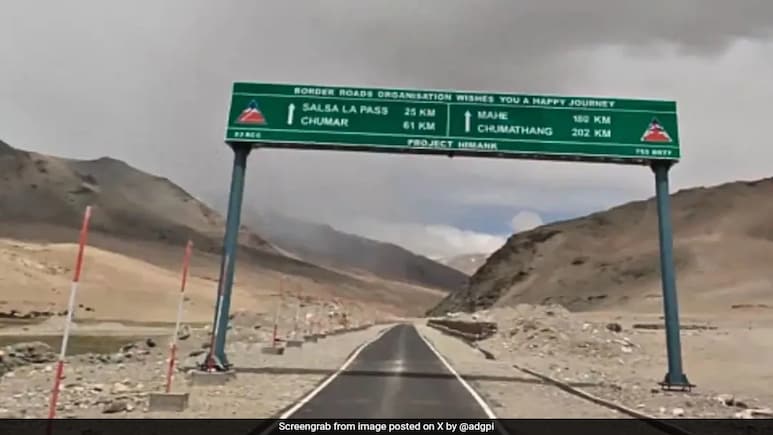
- The Hanle-Chumar route crosses altitudes between 14,500 feet and 17,200 feet, the Army said
- It links key sites like the Hanle Observatory and Tso Moriri to boost tourism
- The road enhances military readiness and supports socio-economic growth in Ladakh
The 91-kilometre strategic road connecting Hanle to the border village of Chumar in Ladakh has been thrown open to the public, the Army said on Tuesday.
The route traverses extreme high altitudes ranging from 14,500 feet to 17,200 feet, including the high Salsa La Pass.
"A 91 km road connecting Hanle to the border village of Chumar, constructed by Project Himank of the Border Roads Organisation, has been opened for public in Ladakh," the Army said on its official X handle.
HANLE–CHUMAR ROAD OPENS FOR THE PUBLIC
— ADG PI - INDIAN ARMY (@adgpi) September 23, 2025
A 91 km road connecting Hanle to the border village of Chumar constructed by #ProjectHimank of the Border Roads Organisation, #BRO has been opened for the Public in Ladakh. The route traverses extreme high altitudes from 14,500 to 17,200… pic.twitter.com/C9uNfLAiBg
"The road, while providing strategic connectivity for the Armed Forces along the borders, will also facilitate local connectivity and tourism in the region by connecting attractions including Hanle Observatory, Kyun Tso Lake, Chilling Tso Lake, and onward to Tso Moriri," the Army said.
It said the road stands as a significant achievement in strategic infrastructure development, enhancing operational readiness, promoting tourism, and boosting socio-economic growth in Ladakh's remote areas.
(Except for the headline, this story has not been edited by NDTV staff and is published from a syndicated feed.)
Track Latest News Live on NDTV.com and get news updates from India and around the world

