





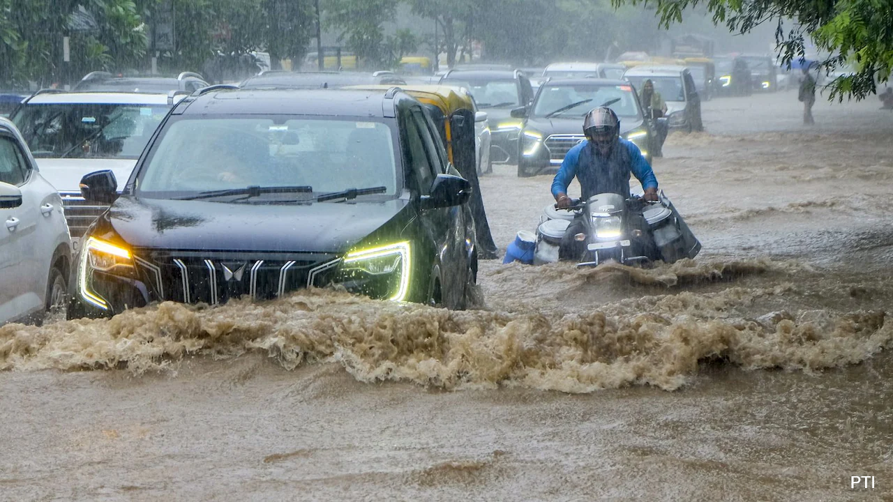
The National Capital Region woke up to rain on Friday and has been witnessing heavy downpours since then. Despite it being just the first week of August, the region is experiencing a prolonged spell of continuous rainfall. While these spells have brought down maximum temperatures and created pleasant weather across the area, they have also ushered in heavy traffic and waterlogging in several parts.
As per official notifications issued by the India Meteorological Department (IMD), the capital saw a "fall in maximum temperatures by 3 to 6 degrees Celsius over Delhi during the past 24 hours," with daytime maximums staying "markedly below normal (-5.1 degrees Celsius or less) at most parts of Delhi".
Weather Systems
To understand what is driving these heavy spells, one must look at a variety of factors. Meteorologists are attributing the showers to a rare alignment of multiple weather features acting simultaneously across Northern India.
NDTV spoke to Mahesh Palawat, Vice President of Meteorology and Climate Change at Skymet Weather, regarding these regional atmospheric drivers. Palawat explained, "The ongoing wet spell is the outcome of a rare interaction among several distinct atmospheric phenomena. A cyclonic circulation over Gangetic West Bengal - developing into a low-pressure formation - is actively directing humid, moisture-laden winds from the Bay of Bengal straight into Northwest India, including Delhi, Punjab, Haryana, and Uttar Pradesh."
The IMD, too, has officially confirmed these key atmospheric drivers. Noting the factors triggering the heavy spells, the IMD has acknowledged that a "low pressure area over southwest Uttar Pradesh and neighbourhood along with associated cyclonic circulation extending up to 4.5 km above mean sea level persists".
Monsoon Trough Alignment
The IMD has also acknowledged a monsoon trough at mean sea level, which "continue to pass through Ganganagar, Delhi, centre of low-pressure area over southwest Uttar Pradesh and neighbourhood, Ranchi, Digha and thence southeastwards Eastcentral Bay of Bengal".
A monsoon trough is a long belt of low pressure that pulls heavy rain clouds across the country. At present, this line is running directly through Delhi, connecting weather systems all the way from Rajasthan to the Bay of Bengal. As Delhi lies directly on this path, rain clouds are constantly being pulled straight over the city, keeping the rainfall steady and heavy.
Western Disturbance
The IMD has explicitly identified the upper-air system at play: "The Western Disturbance as a trough in middle and upper tropospheric westerlies with its axis at 5.8 km above mean sea level roughly along Long. 73 degree East to the north of Lat. 29 degree North persists".
A Western Disturbance is a high-altitude storm system coming from the West (over the Himalayas and North India). Right now, this system is moving high up in the atmosphere (about 5.8 km in the air) just to the north of Delhi. When a Western Disturbance clashes with regular monsoon winds, it intensifies the rain and making the showers last much longer than usual.
As rainfall persists, the data remains subject to change. However, primary rainfall metrics logged across major IMD weather stations show widespread and intense localised precipitation.
Between 08:30 am and 05:30 pm on August 7, 2026, several locations in the capital crossed the 100 mm mark, led by Pushp Vihar (111.5 mm) and Chhatarpur (104.5 mm). Other major readings during this period included: Ayanagar: 87.4 mm, Palam: 73.5 mm. Janakpuri: 68.0 mm, Haroda Kalan: 67.0 mm, Pusa: 59.5 mm, Safdarjung: 57.3 mm (following 59.2 mm recorded in the 24 hours prior).
Forecast And Travel Advisory
The IMD forecasts that the monsoon trough will continue to move near Delhi-NCR, keeping conditions cloudy with on-and-off rain. The IMD has termed the forecast for August 8 as "generally cloudy" with "very light to light rain at many places and moderate rain at isolated places during early morning to noon". The department further says that another spell could occur in the evening/night". For the days that follow, the IMD has predicted that intermittent "very light to light rain" will persist, with maximum temperatures gradually stabilising between 32 degrees Celsius and 35 degrees Celsius from August 9 to 13.
Warning of hazardous road conditions, the IMD has also outlined expected impacts, including traffic, road accidents, and waterlogging. The department has advised residents to check for traffic congestion, follow advisories, and avoid areas prone to waterlogging.
Track Latest News Live on NDTV.com and get news updates from India and around the world

