


The Siachen Glacier is the highest and coldest battlefield in the world at an average altitude of 20,000 feet. The temperature dips to minus 60 degrees in the winter.
Civilians are usually not allowed to go beyond Panamik, a small village in the Nubra Valley famous for its hot sulphur springs. The annual Siachen civilian trek organised by the Indian Army, gives them a chance to trek up to the icy heights of the glacier.
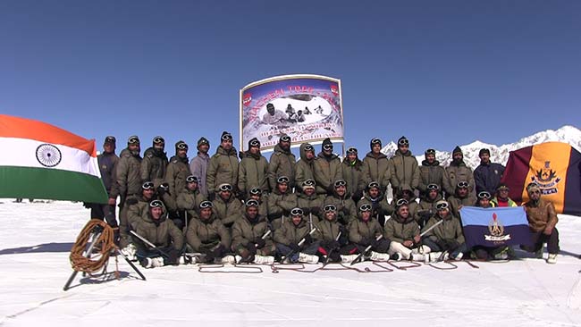
The Army takes around 40 people, including its experts, two journalists, defence scientists, school cadets and "civilian volunteers," on the "unique adventure trip".
On September 15 this year, 36 selected members reported for the trip at Leh in Jammu & Kashmir. I was one of them.
It was the first step in our arduous journey and for the next two days we were allowed to do nothing but sleep and eat. Leh is situated at a height of 11,300 feet and it is crucial to get acclimatised to the thin air before climbing higher.
The next four days were spent well exploring the beautiful, historical monuments in and around Leh.

All this while, medical check-ups and acclimatisation were on and only 32 of 36 members were allowed to proceed to the Siachen base camp. Four members were ruled out as medically unfit.
The Siachen base camp is situated at the snout of the glacier, on the bank of the river Nubra, at a height of 12,000 feet above sea level. The Indian Army mans glacier operations from this base camp and all activities like food supplies and medical assistance to the jawans posted at the glacier are carried out from here.
Not far, is the Siachen Battle School, the world's highest elevation military training academy. It trains batches of around 500- 600 soldiers in ice craft and other survival techniques before they are inducted at the glacier.
For the next one week, we were trained at the Battle School, learning skills like ice crafting, rock crafting, running with loaded rucksacks.
After eight days of rigorous training and acclimatisation it was time for medical clearance. One could move ahead only if one cleared all medical checks. The examination included electrocardiogram or ECG, blood pressure and the level of oxygen in the blood.
Only 24 would qualify to go forward from the base camp. Eight members of the group had high blood pressure.
At the base camp we learnt from inspirational quotes written everywhere that choppers that rescue troops from higher posts are called Siachen Saviours; Doctors are called Siachen Healers and engineers are called Siachen Sappers.
On the inhospitable freezing heights of the world's highest battle field, Indian soldiers have a guardian angel - OP Baba.
Legend has it that OP Baba was a soldier who went missing in the eighties. Today, soldiers here say OP Baba keeps them alive. So deep rooted is that conviction that no soldier steps on the glacier without taking the permission and blessings of OP Baba at a shrine to him. Many do not drink alcohol or smoke once they have crossed the shrine and until they are back from their 90-day stint at the glacier.
Our journey too began with blessings of OP Baba and the link commander who guided us for half of the way from the base camp to camp 1, would frequently report to Baba on the number of people climbing.
After two weeks of acclimatisation and training on the use of glacial equipment we finally got a chance to wear those white jackets and white shoes that weigh more than three kg.
We were attached to each other with a rope and we were ready to trek 60 km from the base camp to our final destination, the Kumar Post situated at a height of 16,000 feet. We would trek 12 km from base camp to camp 1, 14 km from camp 1 to camp 2, 16 km from camp 2 to camp 3 and would now trek 18 km from camp 3 to Kumar Post.
Bound to each other with the thick ropes, we trekked across the harsh terrain, through moraines, glaciers and deep crevasses.
It took us six hours to trek the 12 km to camp 1. At a height of 13,000 feet, it acts as a transit camp for all troops who inducted or de-inducted at the glacier. They halt for a night and the camp is covered with small white tents.
A few Army personnel and porters are deployed at the camp for a tenure of three months each. Due to the freezing temperature, all of them had long beards and their green jackets had turned black from the fumes of kerosene oil, the only fuel used there.
The next morning we started for camp 2. The gusts of wind were heavy at times, but it was breathtakingly beautiful. Everything around us was frozen and cold and white.
On the way, we also crossed quite a few crevasses, for me, the most terrifying part of the trek. The crevasses looked scary, but this was also the most beautiful part of the glacier - pure and serene.
On the way, it was most astonishing was to see some big rocks balanced on small ice pillars. I was told that due to an increase in the temperature the glacier is melting at an unprecedented pace. The snow around the big rocks has melted, but the area covered by the rocks cant melt, causing the peculiar T shapes.
The snout of the glacier has receded more than a kilometre in a decade. The most alarming sign is the vertical thinning of the glacier which is aggravating the widening of crevasses at a massive scale.
We finally reached camp 2. In the evening, one of the members in our group reported chilblains in two fingers of his left hand. He had to be taken back to the base camp by helicopter the next day.
We made a one-night halt each at camp 2 and camp 3, and then began the final journey towards Kumar Post, situated at the height of 16,000 feet.
At every camp our pockets were loaded with nuts and chocolates. Whenever I felt low on energy, a piece of chocolate would immediately help. We also drank a lot of water.
On our way to Kumar Post, there was continuous snowfall and at some places on the ridges, the ground beneath our feet was just half a foot wide, with more than a 100 ft-fall on either side. It was dangerous but we were somehow able to cross it.
Finally, after a continuous trek of four long days we covered the distance of 60 km, ropes hanging on our bodies and ice axes in our hands.
Kumar Post is named after a living legend, Col. Narendra Kumar also known as 'Bull Kumar". He is known for the mountaineering reconnaissance expedition he undertook in Teram Kangri, Siachen Glacier for Indian Army in 1978. It was because of the information he had collated and given to the Army that Armed forces were able to assault and conquer the Siachen Glacier, due to which an entire post was named after him.
It is situated on a ridge of the glacier with a welcome board on the gate and Buddhist prayer flags all around.
The legend on the board will remain with me throughout my life:
LAND SO BARREN AND MOUNTAINS SO HIGH
THAT ONLY THE BEST OF FRIENDS
OR WORST OF ENEMIES COME AND VISIT US.
Compared to the forward post, Kumar offers luxurious accommodation and relative safety. Although this too is within enemy fire range, like the base camp, there is little risk.
The Indian Air Force has deployed light helicopters and planes in the Siachen Glacier.
These low capacity copters carry troops as well as other resources. The IAF executes the Herculean task of supplying logistical equipment and food in the Siachen Glacier. At times when landing is deemed unsafe, packages are air dropped in chutes. The sight of the packages being dropped is beautiful; the small white parachutes look amazingly pretty in the blue sky.
The Siachen Glacier continues to be a challenging battlefield for the Armed Forces. 97% casualties in Siachen have caused by the weather and altitude, rather than actual fighting. In this region men fight for oxygen on icy mountain peaks at an altitude up to 23000 ft.
We were able to reach the final destination only because of Army officers, jawans and ustads (trainers) who helped us in every step.
For us, it was just an expedition. We went up there, clicked a picture and came back, but these soldiers have to stay there whether the temperature is minus 60 or 30 degrees, whether the snow is 20 feet or two feet and even when the cold winds blow away their tents.
According to the present ground positions, India maintains control over most of the Siachen Glacier and all of its tributary glaciers including the major passes of Saltoro Ridge.
Operation Meghdoot, launched on 13 April 1984, was unique as it was the first assault launched in the world's highest battlefield. It is the longest military operation till date. After the 2003 ceasefire there has been no exchange of bullets but still the fight is on for the soldiers. It is a fight against nature, a fight for oxygen on icy mountain peaks at an altitude of 23,000 feet and a fight against one's own physical, mental and emotional limits. Every year, more soldiers are killed because of severe weather than enemy firing. The two sides have lost close to 4,000 personnel primarily due to frostbites, avalanches and other complications.
(Aamir Rafiq is a producer with NDTV Prime. He was part of the the annual Siachen civilian trek organised by the Indian Army.)
Disclaimer: The opinions expressed within this article are the personal opinions of the author. The facts and opinions appearing in the article do not reflect the views of NDTV and NDTV does not assume any responsibility or liability for the same.
Civilians are usually not allowed to go beyond Panamik, a small village in the Nubra Valley famous for its hot sulphur springs. The annual Siachen civilian trek organised by the Indian Army, gives them a chance to trek up to the icy heights of the glacier.
The Army takes around 40 people, including its experts, two journalists, defence scientists, school cadets and "civilian volunteers," on the "unique adventure trip".
On September 15 this year, 36 selected members reported for the trip at Leh in Jammu & Kashmir. I was one of them.
It was the first step in our arduous journey and for the next two days we were allowed to do nothing but sleep and eat. Leh is situated at a height of 11,300 feet and it is crucial to get acclimatised to the thin air before climbing higher.
The next four days were spent well exploring the beautiful, historical monuments in and around Leh.

All this while, medical check-ups and acclimatisation were on and only 32 of 36 members were allowed to proceed to the Siachen base camp. Four members were ruled out as medically unfit.
The Siachen base camp is situated at the snout of the glacier, on the bank of the river Nubra, at a height of 12,000 feet above sea level. The Indian Army mans glacier operations from this base camp and all activities like food supplies and medical assistance to the jawans posted at the glacier are carried out from here.
Not far, is the Siachen Battle School, the world's highest elevation military training academy. It trains batches of around 500- 600 soldiers in ice craft and other survival techniques before they are inducted at the glacier.
For the next one week, we were trained at the Battle School, learning skills like ice crafting, rock crafting, running with loaded rucksacks.

After eight days of rigorous training and acclimatisation it was time for medical clearance. One could move ahead only if one cleared all medical checks. The examination included electrocardiogram or ECG, blood pressure and the level of oxygen in the blood.
Only 24 would qualify to go forward from the base camp. Eight members of the group had high blood pressure.
At the base camp we learnt from inspirational quotes written everywhere that choppers that rescue troops from higher posts are called Siachen Saviours; Doctors are called Siachen Healers and engineers are called Siachen Sappers.

On the inhospitable freezing heights of the world's highest battle field, Indian soldiers have a guardian angel - OP Baba.
Legend has it that OP Baba was a soldier who went missing in the eighties. Today, soldiers here say OP Baba keeps them alive. So deep rooted is that conviction that no soldier steps on the glacier without taking the permission and blessings of OP Baba at a shrine to him. Many do not drink alcohol or smoke once they have crossed the shrine and until they are back from their 90-day stint at the glacier.
Our journey too began with blessings of OP Baba and the link commander who guided us for half of the way from the base camp to camp 1, would frequently report to Baba on the number of people climbing.

After two weeks of acclimatisation and training on the use of glacial equipment we finally got a chance to wear those white jackets and white shoes that weigh more than three kg.
We were attached to each other with a rope and we were ready to trek 60 km from the base camp to our final destination, the Kumar Post situated at a height of 16,000 feet. We would trek 12 km from base camp to camp 1, 14 km from camp 1 to camp 2, 16 km from camp 2 to camp 3 and would now trek 18 km from camp 3 to Kumar Post.
Bound to each other with the thick ropes, we trekked across the harsh terrain, through moraines, glaciers and deep crevasses.

It took us six hours to trek the 12 km to camp 1. At a height of 13,000 feet, it acts as a transit camp for all troops who inducted or de-inducted at the glacier. They halt for a night and the camp is covered with small white tents.
A few Army personnel and porters are deployed at the camp for a tenure of three months each. Due to the freezing temperature, all of them had long beards and their green jackets had turned black from the fumes of kerosene oil, the only fuel used there.

The next morning we started for camp 2. The gusts of wind were heavy at times, but it was breathtakingly beautiful. Everything around us was frozen and cold and white.
On the way, we also crossed quite a few crevasses, for me, the most terrifying part of the trek. The crevasses looked scary, but this was also the most beautiful part of the glacier - pure and serene.

On the way, it was most astonishing was to see some big rocks balanced on small ice pillars. I was told that due to an increase in the temperature the glacier is melting at an unprecedented pace. The snow around the big rocks has melted, but the area covered by the rocks cant melt, causing the peculiar T shapes.
The snout of the glacier has receded more than a kilometre in a decade. The most alarming sign is the vertical thinning of the glacier which is aggravating the widening of crevasses at a massive scale.

We finally reached camp 2. In the evening, one of the members in our group reported chilblains in two fingers of his left hand. He had to be taken back to the base camp by helicopter the next day.
We made a one-night halt each at camp 2 and camp 3, and then began the final journey towards Kumar Post, situated at the height of 16,000 feet.
At every camp our pockets were loaded with nuts and chocolates. Whenever I felt low on energy, a piece of chocolate would immediately help. We also drank a lot of water.
On our way to Kumar Post, there was continuous snowfall and at some places on the ridges, the ground beneath our feet was just half a foot wide, with more than a 100 ft-fall on either side. It was dangerous but we were somehow able to cross it.

Finally, after a continuous trek of four long days we covered the distance of 60 km, ropes hanging on our bodies and ice axes in our hands.
Kumar Post is named after a living legend, Col. Narendra Kumar also known as 'Bull Kumar". He is known for the mountaineering reconnaissance expedition he undertook in Teram Kangri, Siachen Glacier for Indian Army in 1978. It was because of the information he had collated and given to the Army that Armed forces were able to assault and conquer the Siachen Glacier, due to which an entire post was named after him.
It is situated on a ridge of the glacier with a welcome board on the gate and Buddhist prayer flags all around.
The legend on the board will remain with me throughout my life:
LAND SO BARREN AND MOUNTAINS SO HIGH
THAT ONLY THE BEST OF FRIENDS
OR WORST OF ENEMIES COME AND VISIT US.

Compared to the forward post, Kumar offers luxurious accommodation and relative safety. Although this too is within enemy fire range, like the base camp, there is little risk.
The Indian Air Force has deployed light helicopters and planes in the Siachen Glacier.
These low capacity copters carry troops as well as other resources. The IAF executes the Herculean task of supplying logistical equipment and food in the Siachen Glacier. At times when landing is deemed unsafe, packages are air dropped in chutes. The sight of the packages being dropped is beautiful; the small white parachutes look amazingly pretty in the blue sky.

The Siachen Glacier continues to be a challenging battlefield for the Armed Forces. 97% casualties in Siachen have caused by the weather and altitude, rather than actual fighting. In this region men fight for oxygen on icy mountain peaks at an altitude up to 23000 ft.
We were able to reach the final destination only because of Army officers, jawans and ustads (trainers) who helped us in every step.
For us, it was just an expedition. We went up there, clicked a picture and came back, but these soldiers have to stay there whether the temperature is minus 60 or 30 degrees, whether the snow is 20 feet or two feet and even when the cold winds blow away their tents.
According to the present ground positions, India maintains control over most of the Siachen Glacier and all of its tributary glaciers including the major passes of Saltoro Ridge.
Operation Meghdoot, launched on 13 April 1984, was unique as it was the first assault launched in the world's highest battlefield. It is the longest military operation till date. After the 2003 ceasefire there has been no exchange of bullets but still the fight is on for the soldiers. It is a fight against nature, a fight for oxygen on icy mountain peaks at an altitude of 23,000 feet and a fight against one's own physical, mental and emotional limits. Every year, more soldiers are killed because of severe weather than enemy firing. The two sides have lost close to 4,000 personnel primarily due to frostbites, avalanches and other complications.
(Aamir Rafiq is a producer with NDTV Prime. He was part of the the annual Siachen civilian trek organised by the Indian Army.)
Disclaimer: The opinions expressed within this article are the personal opinions of the author. The facts and opinions appearing in the article do not reflect the views of NDTV and NDTV does not assume any responsibility or liability for the same.
How may i help you today
Show full article
Track Latest News Live on NDTV.com and get news updates from India and around the world
