Vegetation Maps
- All
- News
-

NASA-ISRO NISAR Satellite Prepares to Deliver Sharpest-Ever Views of Earth
- Sunday August 31, 2025
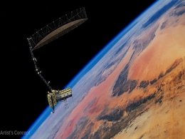
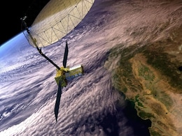
The NISAR satellite, developed by NASA and ISRO, is ready to begin full science operations. Using dual-band radar, it will provide high-precision data on land movement, ice dynamics, vegetation, and natural hazards, supporting global research and disaster management efforts.
-
 www.gadgets360.com
-

NASA and ISRO Prepare to Launch NISAR Earth-Mapping Satellite
- Friday July 18, 2025
NASA and India’s ISRO are set to launch NISAR, a first-of-its-kind Earth-observing satellite equipped with advanced dual-band radar. Scheduled to lift off no earlier than late July 2025 from Sriharikota, India, NISAR will map nearly all of Earth’s land and ice every 12 days, capturing surface changes with centimeter-level precision. Its L-band ...
-
 www.gadgets360.com
-

How Earth Changed In 20 Years, Captured In Captivating NASA Animation
- Sunday November 19, 2017
- World News | Press Trust of India
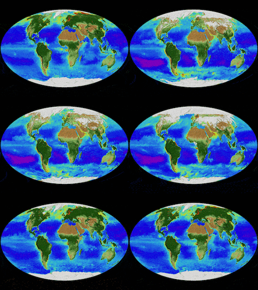
NASA scientists have compiled a captivating video that maps how the Earth's surface has changed over a span of 20 years, using data from satellites. In the Northern Hemisphere, ecosystems wake up in the spring and sprout new leaves, while a fleet of Earth-observing satellites track the spread of the newly green vegetation
-
 www.ndtv.com
-

New Vegetation Map Unveils Changes To Earth's Ecosystems
- Monday August 15, 2016
- World News | Press Trust of India
Researchers have developed a new system to map the world's "biomes" - large-scale vegetation formations - that may help track the effect of climate change on Earth's ecosystems.
-
 www.ndtv.com
-

NASA-ISRO NISAR Satellite Prepares to Deliver Sharpest-Ever Views of Earth
- Sunday August 31, 2025
The NISAR satellite, developed by NASA and ISRO, is ready to begin full science operations. Using dual-band radar, it will provide high-precision data on land movement, ice dynamics, vegetation, and natural hazards, supporting global research and disaster management efforts.
-
 www.gadgets360.com
-

NASA and ISRO Prepare to Launch NISAR Earth-Mapping Satellite
- Friday July 18, 2025
NASA and India’s ISRO are set to launch NISAR, a first-of-its-kind Earth-observing satellite equipped with advanced dual-band radar. Scheduled to lift off no earlier than late July 2025 from Sriharikota, India, NISAR will map nearly all of Earth’s land and ice every 12 days, capturing surface changes with centimeter-level precision. Its L-band ...
-
 www.gadgets360.com
-

How Earth Changed In 20 Years, Captured In Captivating NASA Animation
- Sunday November 19, 2017
- World News | Press Trust of India
NASA scientists have compiled a captivating video that maps how the Earth's surface has changed over a span of 20 years, using data from satellites. In the Northern Hemisphere, ecosystems wake up in the spring and sprout new leaves, while a fleet of Earth-observing satellites track the spread of the newly green vegetation
-
 www.ndtv.com
-

New Vegetation Map Unveils Changes To Earth's Ecosystems
- Monday August 15, 2016
- World News | Press Trust of India
Researchers have developed a new system to map the world's "biomes" - large-scale vegetation formations - that may help track the effect of climate change on Earth's ecosystems.
-
 www.ndtv.com


