





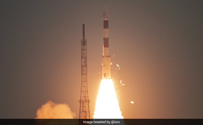
The Indian Space Research Organisation or ISRO hit another milestone today of launching over 300 foreign satellites. The latest being the indigenous CARTOSAT-3 satellite and 13 other nano satellites from the US. The launch of 14 new satellites took place today at 9:28 am from Satish Dhawan Space Centre in Andhra Pradesh's Sriharikota. Heavy-lift rocket PSLV-C47 was used to carry the satellites into the orbit. "CARTOSAT-3 is India's highest resolution civilian satellite, and the most complex and advanced earth observation satellite that ISRO has built so far," ISRO Chairman K Sivan was quoted as saying by news agency Press Trust of India. Prime Minister Narendra Modi tweeted congratulatory message for the ISRO team. "I heartily congratulate the entire ISRO Team on yet another successful launch of PSLV-C47 carrying indigenous CARTOSAT-3 satellite and over a dozen nano satellites of USA," PM Modi wrote in a tweet. The launch has reinforce India as a global launch destination for small satellites using Polar Satellite Launch Vehicle (PSLV).
Cartosat-3 satellite: Know About ISRO's earth imaging satellite in 5 points
CARTOSAT-3 is an Earth imaging and mapping satellite that can take high-resolution photos of the Earth.
CARTOSAT-3 the third generation agile advanced satellite, was successfully placed into the orbit 509 km from the Earth today. Besides the Cartosat-3, the PSLV C-47 rocket carried 13 other commercial nanosatellites from the US and successfully placed them in the orbit, ISRO said.
The weight of CARTOSAT-3 earth-imaging satellite is 1,625 kg.
The mission life of CARTOSAT-3 is five years.
The main objective of ISRO's new earth imaging satellite is to help its users in planning large-scale urban projects, rural resource and infrastructure development and keeping track of coastal and land cover. The satellite is also expected to help in military reconnaissance.

