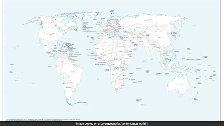
India has flagged the "anomalies" in the new world map issued by the United Nations after it depicted Arunachal Pradesh and Aksai Chin -- two integral parts of the country-- as separate regions positioned between the Indian and Chinese border claims. The move came days after India backed the United Nations General Assembly (UNGA) resolution calling for more accurate and equitable cartographic representation of the world's regions.
The foreign ministry said India has backed the resolution focused on promoting equal-area maps, but its support should not be interpreted as approval of any specific map.
"On your question about the UNGA resolution, when this resolution was adopted, we favoured the resolution and voted in favour of the resolution. When the resolution was adopted in the UN General Assembly, we also made a statement where we clarified our position," Foreign Ministry spokesperson Randhir Jaiswal said, reiterating India's position.
He stressed the resolution is focused on the principle of equal-area maps and does not endorse any map of any private party or any particular entity.
"The resolution is focused on the principle of having, giving weightage or giving credence to equal-area maps, so that, as we have said, the equal-area maps project or preserve the relative sizes of continental landmarks," he added.
Jaiswal noted that there may be maps for consultation. "We have taken up the anomalies with the concerned persons," he said.
#WATCH | Delhi: MEA Official Spokesperson Randhir Jaiswal said, “On your question about the UNGA resolution, when this resolution was adopted, we favoured the resolution and voted in favour of the resolution. When the resolution was adopted in the UN General Assembly, we also… pic.twitter.com/6iRqtqcq8j
— ANI (@ANI) September 8, 2026
India has consistently maintained that the entire Union Territory of Jammu and Kashmir and Ladakh, including Aksai Chin, "has been, is, and will always be an integral and inalienable part of India." New Delhi also maintains that Arunachal Pradesh is an integral part of Indian territory.
Anomalies in Map
The clarification came after a map, first published by the UN on July 1 and extensively used during discussions regarding the United Nations UNGA resolution, depicted Arunachal Pradesh as an independent state bordering Assam and China, while eliminating the state's border with Nagaland.
Similarly, the map showed Aksai Chin as an independent region with its western side bordering India and its eastern side bordering China. The United Nations did not explain the reason behind the changes.
The map also shows a dotted line indicating the Line of Control (LoC) dividing Jammu and Kashmir between India and Pakistan. However, the United Nations, in the footnotes of the map, mentioned that the "dotted line represents approximately the LoC in Jammu and Kashmir agreed upon by India and Pakistan."
"The final status of Jammu and Kashmir has not yet been agreed upon by the parties," it said.
The UN Resolution
The United Nations General Assembly adopted an African Union-backed resolution titled "Correct the Map" on September 4. The resolution, also backed by India, calls for more accurate and equitable cartographic representation of the world's regions, particularly Africa.
The map is non-binding, but it is understood that it will be adapted to the standard depiction of the world by multilateral institutions worldwide.
The push for equal-area maps stems from concerns over distortions created by traditional geographical charts based on the Mercator projection. Developed in 1569, the Mercator projection was created to help sailors navigate the oceans. It's a flat map of the Earth that turns compass lines (rhumb lines) into straight lines. But it makes areas far from the equator look much bigger than their actual relative size.
The Equal Earth projection, introduced in 2018, makes the opposite trade-off, preserving true area so continents can be compared honestly, at the cost of slightly bending their outlines.
Track Latest News Live on NDTV.com and get news updates from India and around the world


