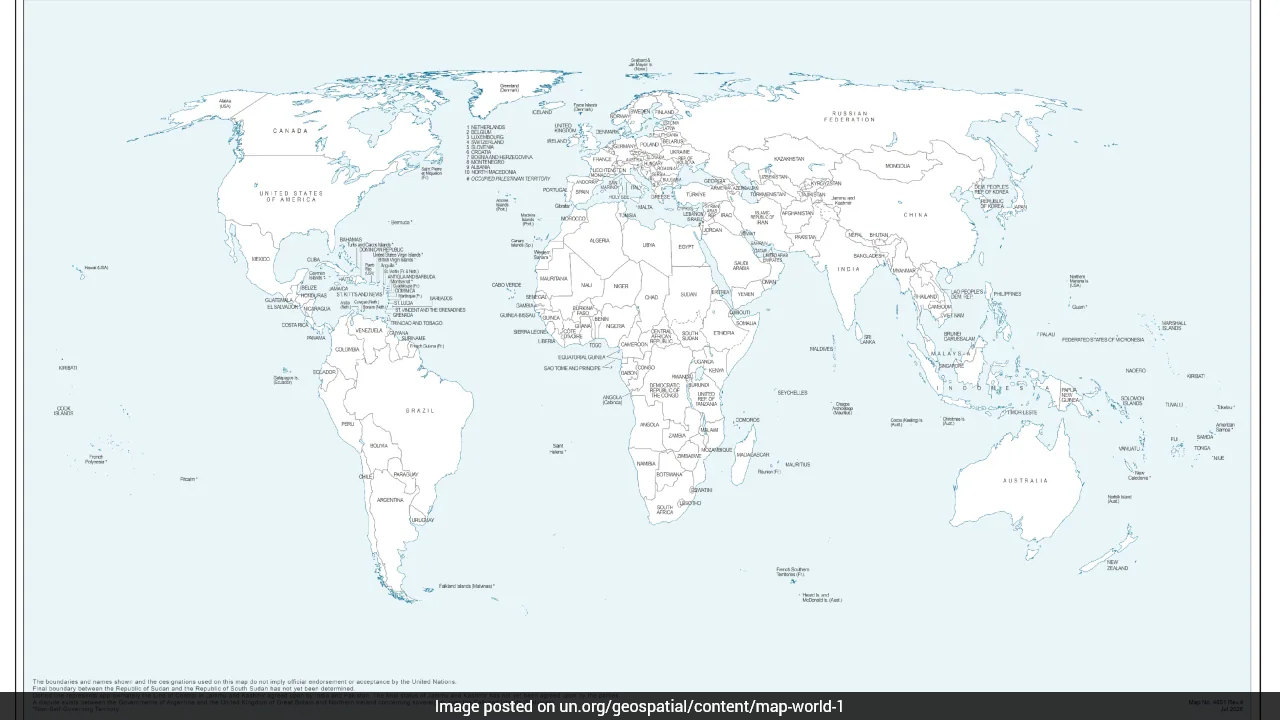
The new map of the world issued by the United Nations, the one backed by India under the 'Correct the map' resolution, has drawn renewed attention as it depicts Arunachal Pradesh and Aksai Chin, which New Delhi maintains as part of Ladakh, as separate regions between Indian and Chinese border claims.
The map was first published on July 1 during discussions regarding the United Nations General Assembly (UNGA) resolution. It eliminates Arunachal Pradesh's border with Nagaland while projecting the region as an independent state bordering Assam and China on the map.
-

-
 The Mystery Of A Bare Nail In Ashwini Vaishnaw's Office
 -
 Paris Setback, Asian Games Glory: Lovlina Borgohain's New Perspective
 -
 To PM Modi's "Failed Product" Jab At Rahul Gandhi, A Shashi Tharoor Counter
 -
 NDTV World Summit 2026: AI, Chips, Warfare And The Future Of The World | Key Conversations
 -
 Kriti Sanon On Situationships, Open Relationships And Being Old-School
 -
 'AI Scares Me': Kriti Sanon On Personality Rights And Need For Laws
 -
 'AI Scares Me': Kriti Sanon On Personality Rights And Need For Laws
 -
 'This Time I Wanted Gold': Savita Punia Reflects On Historic Asiad Success
 -
 Favourite Bollywood Actor To 5-Year Plan, Kriti Sanon Interviews AI Actor Tilly Norwood
 -
 Inside The Mind Of Archer Kumkum Mohod, Who Dared To Challenge South Korea
Similarly, the map shows Aksai Chin as an independent region with its western side bordering India and its eastern side bordering China. The United Nations did not explain the reason behind the changes.
The map also shows a dotted line indicating the Line of Control (LoC) dividing Jammu and Kashmir between India and Pakistan. However, the United Nations, in the footnotes of the map, mentioned that the "dotted line represents approximately the LoC in Jammu and Kashmir agreed upon by India and Pakistan."
"The final status of Jammu and Kashmir has not yet been agreed upon by the parties," it said.
UN Adopts the New Map
The United Nations General Assembly last week adopted an African Union-backed resolution titled "Correct the Map," calling for more accurate and equitable cartographic representation of the world's regions, particularly Africa. The map is non-binding, but it is understood that it will be adapted to the standard depiction of the world by multilateral institutions worldwide.
India's Reaction
The resolution, championed by Togo on behalf of the African Group, was backed by India, with the Foreign Ministry explaining New Delhi's position as a vote on the "underlying principle of promoting equal–area cartographic representation."
"We also highlighted that the resolution does not constitute endorsement of any specific map, projection, or depiction of national boundaries," the Ministry said.
"India's sovereign territory, including the Union Territories of Jammu and Kashmir and Ladakh, must be depicted in accordance with India's official map. Any inaccurate or misleading depiction is unacceptable. Our position on India's sovereignty and territorial integrity is clear, consistent, and non-negotiable," it added.
New Delhi is yet to comment on the map's demarcation of Arunachal Pradesh and Aksai Chin with contesting claim lines from India and China.
India's Position
India has consistently maintained that the entire Union Territory of Jammu and Kashmir and Ladakh, including Aksai Chin, "has been, is and will always be an integral and inalienable part of India." New Delhi also maintains that Arunachal Pradesh is an integral part of Indian territory.
Track Latest News Live on NDTV.com and get news updates from India and around the world


