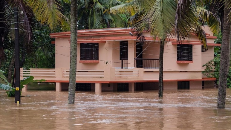

The Indian Institute of Technology (IIT) Bombay has developed a sophisticated artificial intelligence (AI)-based system that can predict flood susceptibility and estimate flood water depths at a 30-meter resolution across South India's vulnerable Western Ghats region.
The initiative aims to address the growing threat of floods, which claim lives and displace lakhs of people due to flash floods triggered by heavy rainfall.
-

-
 "Nobel Laureate In Terms Of Brain Power": CIA Ex-Director On AI Role In Warfare
 -
 "Miscommunication By Eiffel Tower": BAPS Monk On 'Women Sidelined' Claim
 -
 Can AI Become A Substitute For God? Brahmavihari Swamiji On Faith And Technology
 -
 BAPS' Brahmavihari Swamiji Explains Why AI Can't Replace Humanity
 -
 Exclusive: BAPS' Brahmavihari Swamiji Explains Why AI Can't Replace Humanity
 -
 AI Could Be Humanity's First New Species, Says Brahmavihari Swamiji
 -
 Yoga, Millets To Vaccines, Jaishankar On How India Is Building Stronger Ties
 -
 NDTV World Summit Day 2: Navigating A World In Transition
 -
 "US Protecting Its Interest": S Jaishankar On Trump's Oil Deal With Russia
 -
 "World That Relied On India's Brainpower Now Trusts Its Mindpower": PM Modi
By combining satellite radar data with advanced machine learning, researchers at IIT Bombay have developed a high-resolution flood mapping system that identifies flood-prone zones with over 93 per cent accuracy. The system covers an area of around 55,000 square kilometres, stretching from Tadri in Karnataka's Uttara Kannada district to Kanyakumari along the Western Ghats coast in southern India. According to the researchers, the framework could help protect millions living in some of India's most flood-vulnerable coastal regions.
The IIT Bombay team adopted a pattern-recognition approach by analysing multiple conditioning factors instead of depending solely on rainfall data.
The study found that surface runoff is a more reliable predictor of flooding than rainfall volume alone. Explaining the finding, Dr Sadhwani said, "While rainfall is the primary driver of flood events, it does not directly translate into inundation at a given location. Surface runoff represents the integrated hydrological response of the landscape, capturing the combined effects of rainfall intensity, soil moisture, land use, infiltration capacity, and drainage characteristics."
The researchers used a two-stage AI framework to process the data. First, a classification model identifies whether an area is at risk of flooding. It is then followed by a regression model that estimates the likely depth of floodwater, generating a continuous map of potential inundation.
To train the model, the team used the European Space Agency's Sentinel-1 Synthetic Aperture Radar (SAR) satellite imagery, which can penetrate monsoon cloud cover and capture reliable observations. By comparing images taken before and during previous flood events, the AI model learned to identify the dark patches that indicate standing water.
The system produces high-resolution flood maps at a 30-metre grid resolution. It currently operates with a root mean square error (RMSE) of approximately 0.99 metres. While an error margin of about one metre may be significant for detailed urban planning, Dr. Sadhwani said the model's key strength lies in its ability to rapidly assess flood risks across large regions.
"The model is designed for rapid, regional-scale flood assessment, offering high computational efficiency and the ability to generate flood extent and depth information quickly over large areas," Dr Sadhwani said. "This makes it particularly valuable for early-stage planning, prioritisation of vulnerable zones, and emergency response support."
The current framework focuses on terrains with slopes of less than 7%. According to the study, this is a deliberate methodological choice because "flood depth calculations were restricted to areas where the slope was less than 7% to ensure accurate flood inundation mapping with SAR images, considering the potential for water movement during image capture."
The researchers noted that radar signals in steeper terrain are susceptible to geometric distortions such as shadow and layover. Additionally, water movement during satellite image acquisition can reduce the accuracy of flood extent and depth estimates. Applying the slope threshold helps ensure that the derived flood depths remain reliable and physically consistent.
For states such as Kerala and Karnataka, the framework could prove to be a game-changer. In regions characterised by clay-rich soils that retain water and low-lying coastal plains, 30-metre-resolution flood maps can help authorities identify exactly which hospitals, schools, roads and other critical infrastructure are most likely to be inundated.
Dr Sadhwani said the framework can "identify flood-prone areas, guiding urban planning and land use management," while also playing a "critical role in disaster preparedness and response by enabling authorities to allocate resources effectively and prioritise vulnerable regions for evacuation and relief efforts."
Although the current study focused on the southern stretch of India's western coast, the researchers believe the framework can be scaled to complex urban regions such as Mumbai and the country's eastern coastline. However, they noted that doing so would require the inclusion of additional variables, along with recalibration and retraining of the model.
"Coastal environments introduce additional complexities, such as tidal fluctuations, storm surges, sea-level variations, and drainage backflow effects," Dr Sadhwani explained. "The methodology can be effectively adapted by incorporating these coastal-specific parameters into the existing framework."
