
The UK Met Office has issued two red weather warnings in as many months for strong winds. These are the highest threat levels meteorologists can announce, and are the first wind-only red warnings to be issued since 2016's Storm Gertrude.
So what's behind the UK's recent spate of dangerous wind storms? And are these events likely to become more common in future? Storm Arwen in late November 2021 caused devastation across Scotland, northern England and parts of Wales. Winds of 100mph killed three people, ripped up trees, and left 9,000 people without power for over a week in freezing temperatures.
The destruction caused by Arwen is still apparent in some areas, and the clean-up from Storm Dudley - which battered eastern England on Wednesday February 16 - is underway at the time of writing.
Now the UK faces Storm Eunice, and its gusts of up to 122 miles per hour. Eunice bears a striking similarity to the "Great Storm" of 1987, which unleashed hurricane-force winds and claimed 22 lives across Britain and France in October of that year.
Both are predicted to contain a "sting jet": a small, narrow airstream that can form inside a storm and produce intense winds over an area smaller than 100 km.

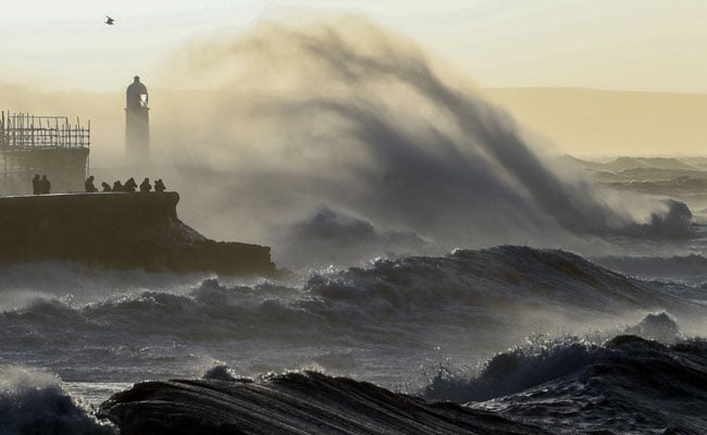
Britain put the army on standby Friday and schools closed as Storm Eunice approached
Sting jets, which were first discovered in 2003, and likely occurred during the Great Storm and Storm Arwen, can last anywhere between one and 12 hours. They are difficult to forecast and relatively rare, but make storms more dangerous.
Sting jets occur in a certain type of extratropical cyclone - a rotating wind system that forms outside of the tropics.
These airstreams form around 5km above the Earth's surface then descend on the southwest side of a cyclone, close to its centre, accelerating as they do and bringing fast-moving air from high in the atmosphere with them.
When they form, they can produce much higher wind speeds on the ground than might otherwise be forecast by studying pressure gradients in the storm's core alone.
Meteorologists are still working to understand sting jets, but they are likely to have a significant influence on the UK's weather in a warming climate.

Wind-damaged sections of the roof of The O2 Arena, formerly the Millennium Dome, are pictured in London
In 1987, the models used for weather forecasts were incapable of representing sting jets, but improvements mean that forecasters predicted Storm Eunice before it had even begun to form in the Atlantic.
Over the past decade, our team at Newcastle University has worked closely with colleagues at the UK Met Office to develop new high-resolution climate models that can simulate sting jets, as well as hail and lightning, to illuminate how extreme weather events might change in a warming climate.
We already know that, as the world warms, downpours are intensifying. The simple reason is that warmer air can hold more moisture. The UK saw the wettest day on record in 2020, already estimated to be 2.5 times more likely because of greenhouse gas emissions.
Our research team's new high-resolution climate models predict bigger increases in winter rainfall than standard global climate models due to a large increase in rainfall from thunderstorms during winter.
We are less certain about how the pattern of extreme wind storms, like Eunice, will change, as the relevant processes are much more complicated.
The UK's recent cluster of winter wind storms is related to a particularly strong polar vortex creating low pressure in the Arctic, and a faster jet stream - a core of very strong wind high in the atmosphere that can extend across the Atlantic - bringing stormier and very wet weather to the UK.
A stronger jet stream makes storms more powerful and its orientation roughly determines the track of the storm and where it affects.
Some aspects of climate change strengthen the jet stream, leading to more UK wind storms. Other aspects, like the higher rate of warming over the poles compared with the equator, may weaken it and the westerly flow of wind towards the UK.
Our high-resolution models predict more intense wind storms over the UK as climate change accelerates, with much of this increase coming from storms that develop sting jets.
Projections from global climate models are uncertain and suggest only small increases in the number of extreme cyclones. But these models fail to represent sting jets and poorly simulate the processes that cause storms to build. As a result, these models probably underestimate future changes in storm intensity.
We think that using high-resolution climate models, which can represent important processes like sting jets, alongside information from global models on how large-scale conditions might change, could give a more accurate picture. But the UK isn't doing enough to prepare for the increasingly severe extreme weather already predicted.
Humanity has a choice in how much warmer the world gets based on the rate at which we reduce greenhouse gas emissions.
While more research will confirm if more extreme wind storms will hit the UK in the future, we are certain that winter storms will produce stronger downpours and more rain and flooding when they do occur.
Track Latest News Live on NDTV.com and get news updates from India and around the world

